
 Portuguese
  Spanish
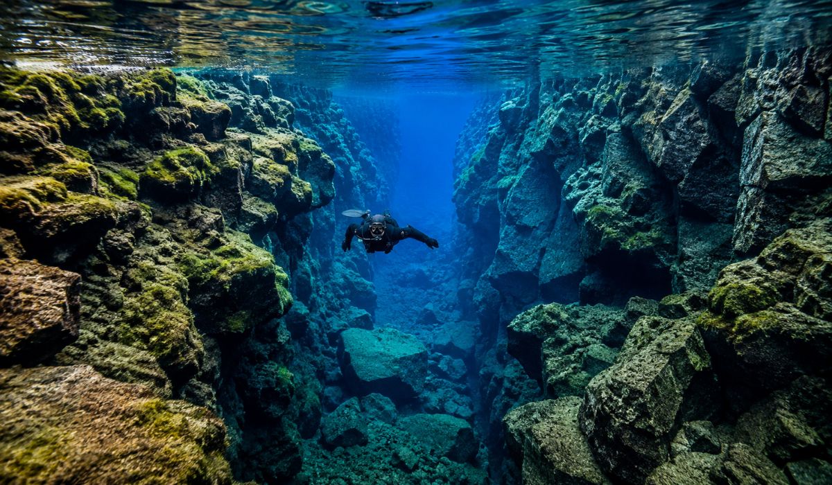
In a submerged fissure in Iceland, glacial water passes through volcanic rocks for decades, creating a rare scenario of extreme transparency in one of the tectonic regions most observed by divers and scientists.
The Silfra Fissure, in Thingvellir National Park, Iceland, is a submerged crack fed by meltwater that passes through lava fields before reaching the surface.
The natural filtration process leaves the water with visibility close to 100 meters in favorable conditions and keeps the temperature low throughout the year, usually between 2 °C and 4 °C.
Located in the northern part of Lake Þingvallavatn, Silfra is part of an area marked by fissures, geological faults, and seismic activity.
-
Crab Trapped in Plastic Bottle for 62 Days Near Okinawa Highlights Little-Known Impact of Marine Pollution on Small Animals

-
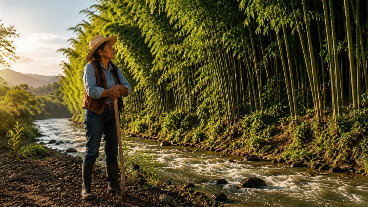
Esperanza’s Bamboo Barrier in Oaxaca Redirects River and Reduces Erosion by 85% in Five Years

-
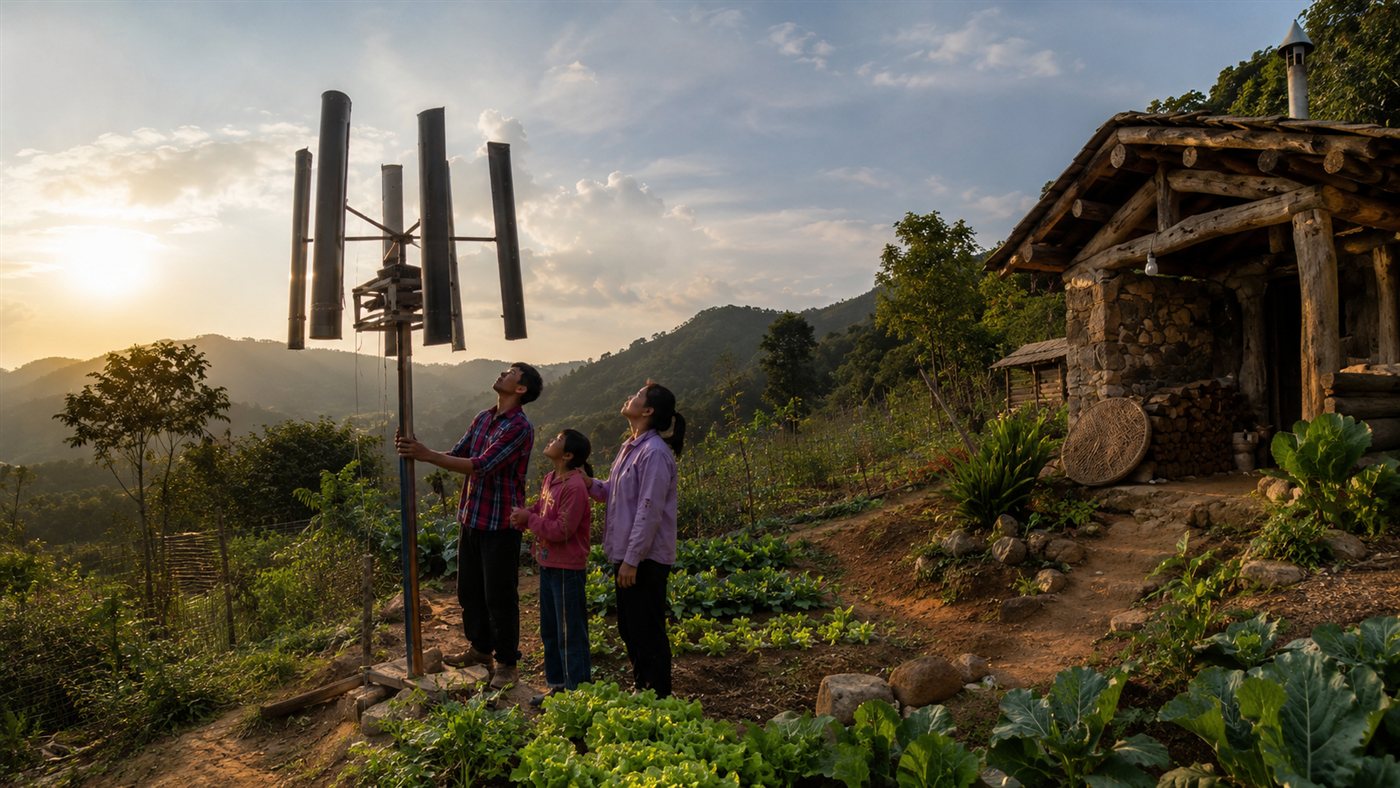
Family Builds Homemade Wind Turbine to Power Off-Grid Home, Video Reaches 555,000 Views on Ngô Thị Huyền’s Channel
-
Indian Brand Creates Sneakers from Recycled PET Bottles and Discarded Tires, Repurposing Over 1 Million Bottles and Raising $4 Million for Expansion


Thingvellir National Park, where the fissure is located, is in an active volcanic region 49 kilometers from Reykjavík and was inscribed as a Unesco World Heritage Site in 2004.
Glacial water filtered by volcanic rocks
The water that reaches Silfra originates from the melting of the Langjökull glacier, one of the largest in Iceland.
After melting, it infiltrates the ground and travels through porous lava fields until it emerges in the fissure, in a process that acts as a natural filter.
According to the Thingvellir National Park, this underground journey takes about 30 years.
Specialized diving operators in the region, such as Dive.is, report that the filtration can last from 30 to 100 years before the water reaches the spring that feeds Silfra.
The difference between the estimates requires careful formulation.
The term “up to 100 years,” used in tourist texts about the fissure, appears in sources linked to diving operations.
The official park source adopts the period of approximately three decades as a reference.
During this journey, the water passes through volcanic rocks, underground fractures, and sediments.
The filtration removes suspended particles and helps explain the transparency recorded at the site.
According to the park administration, when the water reaches the fissure, visibility can reach about 100 meters.
Why Silfra has such transparent water
The clarity of the water is not only related to the underground path.
The low temperature also interferes with environmental conditions, as it limits the presence of suspended organic matter and helps keep the water with low turbidity.
A Guide to Iceland reports that the temperature of Silfra remains between 35 °F and 39 °F, which is equivalent to about 2 °C to 4 °C, in all seasons.
The stability occurs because the water comes from an underground source supplied by glacial meltwater.
For visitors, this condition requires specific equipment.
Snorkeling and diving activities are done with dry suits, thermal insulation, gloves, hoods, and guide accompaniment.
In the case of scuba diving, local operators require certifications and prior experience with dry suits, as the cold and buoyancy control increase the complexity of the activity.

Fissure between tectonic plates in Iceland
Silfra is often described as a diving point between the North American Plate and the Eurasian Plate.
This presentation has become common in tourism because Iceland is on the Mid-Atlantic Ridge, a chain associated with the separation between large tectonic plates.
The official explanation from Thingvellir National Park brings a caveat.
According to the park administration, Silfra is one of about 100 fissures formed in a strip of approximately 5 kilometers between the edges of the North American Plate and the Hreppar microplate.
The agency also informs that the fissure is part of this system, but does not alone correspond to the entire separation between the plates.
This distinction does not change the fact that Silfra is in an area of tectonic expansion.
The fissure allows observing, underwater, a visible part of a broader geological process related to the movement of the crust in Iceland.
The origin of the landscape is also often simplified in tourist accounts.
The earthquake of 1789 opened and modified fissures in the region, but Thingvellir National Park informs that Silfra already existed before this episode, probably more than a thousand years ago, based on geological and historical records.
Size of the Silfra Fissure and underwater route
The fissure is located in the northern portion of Lake Þingvallavatn, within Thingvellir National Park.
According to the park administration, Silfra can be up to 10 meters wide and reach 60 meters deep in some spots.
Diving operators describe the visiting area as a route divided into sectors.
Among the names used are Silfra Big Crack, Silfra Hall, Silfra Cathedral, and Silfra Lagoon.
This division helps guides and visitors identify sections of the route during water activities.
The Big Crack corresponds to the initial part of the route.
Next, the Hall and the Cathedral appear as wider and deeper sections of the fissure.
The Lagoon, in turn, is a shallower and more open area, used as the endpoint in many snorkeling experiences.
The proximity to Reykjavík also favors the flow of visitors.
According to UNESCO, Thingvellir is 49 kilometers east of the Icelandic capital.
Tour guides inform that the car journey usually takes about 45 minutes, depending on weather and road conditions.
A landscape altered by earthquakes and geological faults
Silfra is not a static structure.
In an area subject to seismic shocks, rock displacements can alter cavities, open passages, and modify parts of the submerged landscape.
Dive.is reports that earthquakes have already caused changes in the depth profile of the fissure, with block falls and the formation of new tunnels and underwater terrains.
UNESCO also records that Thingvellir National Park is in an active seismic zone, where the terrain remains subject to natural changes.
According to the organization, the valley floor has sunk 3 to 4 meters since the founding of the Alþing, the historical Icelandic assembly created in 930, and this process is expected to continue.
This context helps explain why the fissure is used in scientific dissemination materials and geological tourism.
The clear water allows observation of rock layers, basaltic walls, and fractures associated with the tectonic dynamics of the region.
Unlike diving areas known for the presence of corals or a great diversity of fish, Silfra is sought mainly for its geology.
The visible life in the fissure includes green algae and aquatic plant formations described by local operators, while the main element of observation remains the rock structure illuminated by the clear water.
What the Silfra Fissure reveals about Iceland
The Silfra Fissure shows a part of Icelandic geology that does not only appear in volcanoes, lava fields, and hot springs.
In the same environment, the region brings together glacial water, porous volcanic rock, open fractures in the crust, and signs of seismic activity.
The combination of these factors transforms the fissure into a point of observation of the country’s subterranean and tectonic landscape.
The water filtered for decades makes visible details that, in other environments, would be covered by sediments or low visibility.
From a scientific perspective, Silfra allows the relation of long-term processes to a direct visual experience.
The water’s journey begins at the glacier, traverses ancient lava, and appears in a fissure associated with the movement of the crust.
The visitor, in turn, observes this system on a reduced scale but connected to phenomena that have shaped Iceland for thousands of years.


