LiDAR

Science and Technology
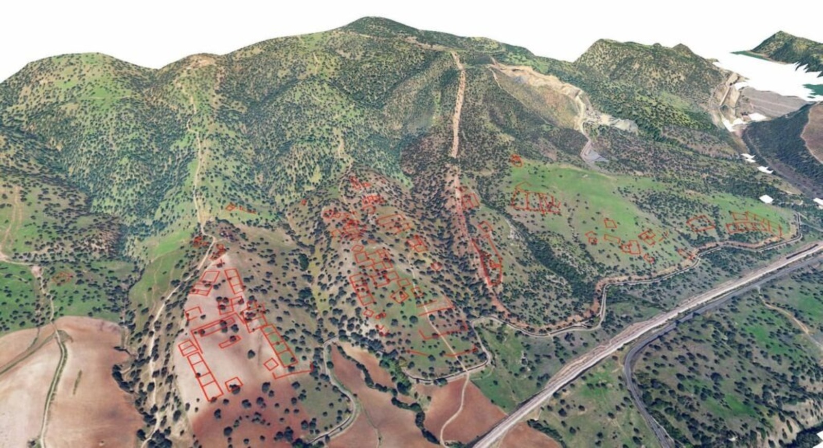
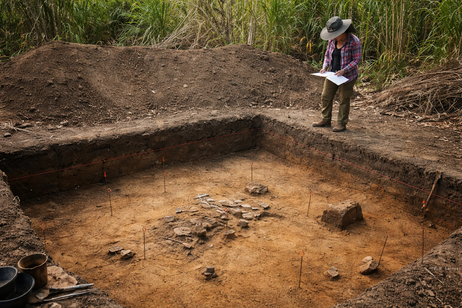
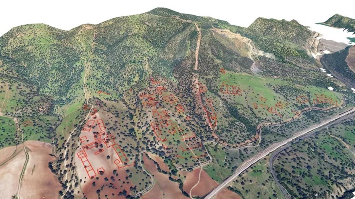
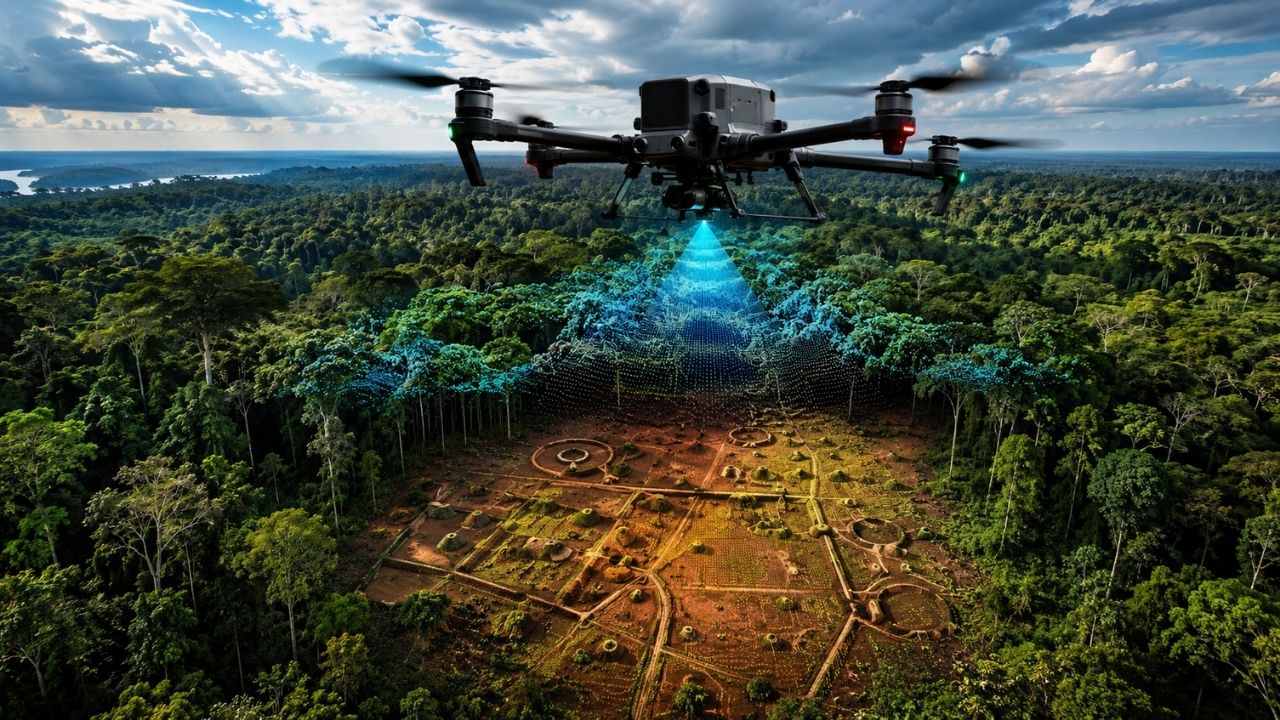
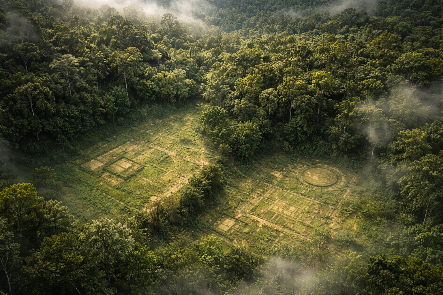
Drone flies over indigenous area in Xingu and creates a point cloud capable of penetrating the tree canopy, revealing the forest floor, and mapping archaeological sites, ancient villages, roads, and ditches used to understand the historical occupation of the Kuikuro territory.
Carla Teles 25/05/2026 at 17:46


Interesting facts