
 Portuguese
  Spanish
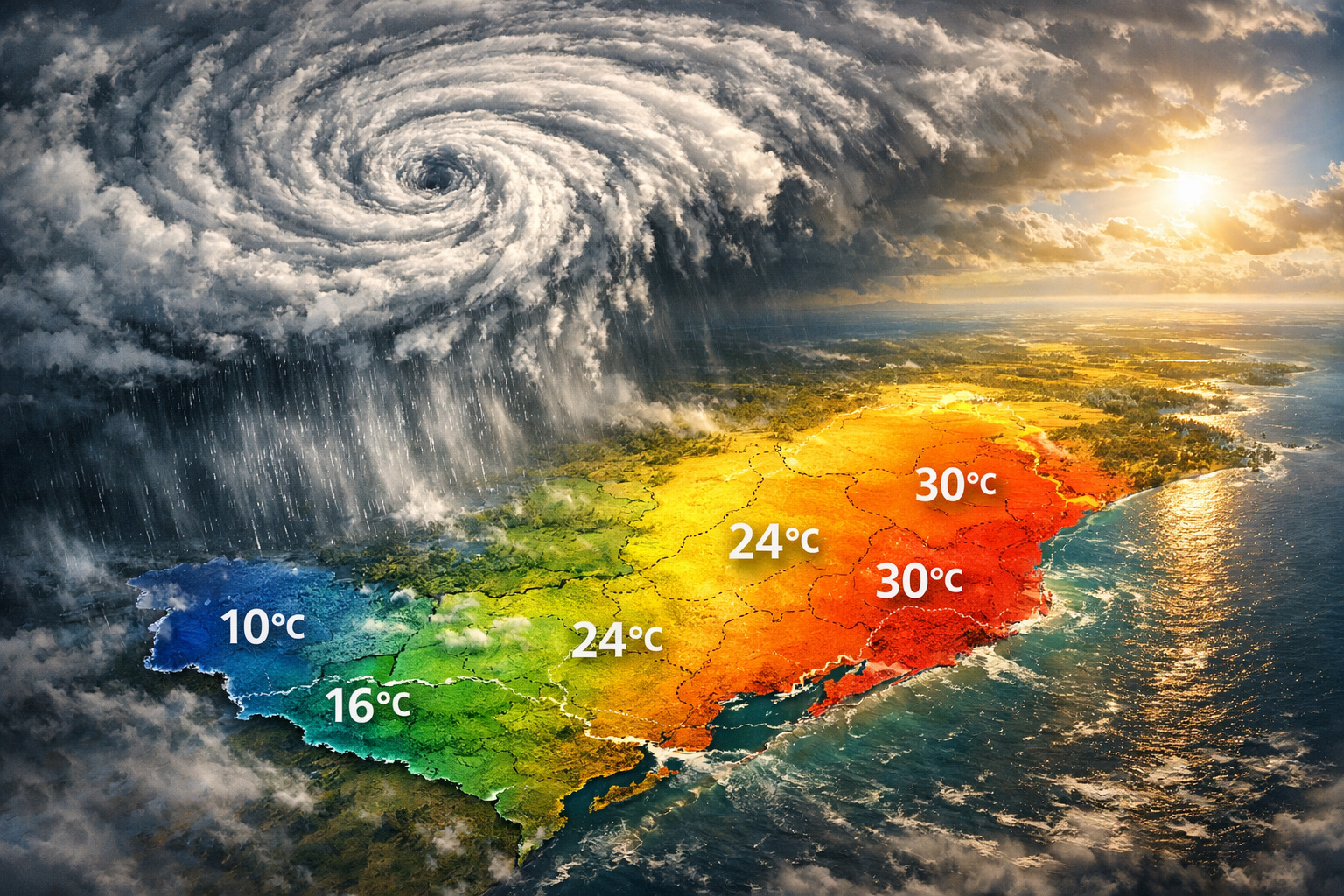
Extreme weather phenomenon transforms the weather in the South with rapid variations, intense rains, and impressive temperature contrasts throughout the week
The action of an extratropical cyclone promises to completely transform the climatic scenario in the Southern Region of Brazil throughout this week, creating an environment marked by instability, rapid changes, and meteorological extremes. This information was released by “ND Mais”, based on data from Meteored and international meteorological models, indicating that the phenomenon is expected to cause a true thermal seesaw in the coming days.
In this sense, the advance of the climatic system between Argentina and the Atlantic Ocean triggers a sequence of events that include irregular rains, periods of sunshine, and significant temperature fluctuations. As a result, residents of the states of Rio Grande do Sul, Santa Catarina, and Paraná should prepare for a dynamic and unpredictable scenario.
Formation of the extratropical cyclone intensifies storms and rainfall volumes in the South
Initially, the extratropical cyclone begins to form between Tuesday (14) and Wednesday (15), starting from a low-pressure area located over Argentina. Subsequently, the system advances towards the Atlantic Ocean until Friday (17), gaining strength along the way.
-
Russia and India Lift 320-Ton Pressure Vessel into Kudankulam Nuclear Plant Reactor, Advancing Project That Has Already Prevented 112 Million Tons of CO2 Emissions

-
Brazilian Student Wins Global Science Fair in the U.S. with Sound Wave Method to Alter Alzheimer’s-Linked Genes
-
Bosch Unveils Revolutionary 2.3 kg Hub Motor for E-Bikes with 45 Nm Torque and 400 Watts Power, Eliminating Resistance Above 25 km/h in Historic Shift for German Manufacturer
-
Brazilian Engineer Develops Marine Bacteria from Ubatuba into a Mini Power Plant Generating 227 mW per Square Meter, Cleans Air by Capturing CO₂ and Releasing Oxygen


During this period, Rio Grande do Sul will be the most impacted state, especially in the Western, Campaign, and Southern regions, where instabilities tend to be more frequent. Already on Tuesday (14), there is a forecast of rain showers in the Western part of Rio Grande do Sul. However, the most significant volumes are expected between Wednesday (15) and Thursday (16), when the system reaches its peak intensity.
Additionally, on Thursday (16), the rains will advance to areas of the western border of Santa Catarina and Paraná, also reaching the eastern half of Rio Grande do Sul. Regions such as the Metropolitan Region of Porto Alegre, Serra Gaúcha, and the southern coast of Santa Catarina may record more intense precipitation.
According to the European model ECMWF, rainfall accumulations may reach or even exceed 80 mm in the Northwest and extreme West of Rio Grande do Sul. In contrast, in other areas of the Southern Region, the volumes are expected to remain below 50 mm, highlighting the irregularity of the precipitation.
Finally, on Friday (17), the trend is for a reduction in instabilities. Still, the occurrence of light rains in parts of Northern and Northwestern Paraná cannot be ruled out.
Thermal seesaw impresses with a difference of up to 15°C between regions on the same day

At the same time that the rains advance, another factor draws attention: the significant temperature variation throughout the days. This behavior reinforces the phenomenon known as thermal seesaw, characterized by abrupt and rapid changes in temperatures.
At the beginning of the week, for example, values below 10°C were recorded in the Serra Catarinense, while the western part of Rio Grande do Sul showed temperatures above 20°C. This difference already indicated the pattern that is expected to intensify in the following days.
During the mornings, the cold tends to prevail, especially in the mountainous areas and the eastern part of the region. On the other hand, throughout the afternoons, temperatures can rise rapidly, reaching close to or even exceeding 30°C in parts of Rio Grande do Sul and in the Northwest of Paraná.
Between Wednesday (15) and Thursday (16), the thermal contrast becomes even more evident. While the central-eastern part of Santa Catarina and the eastern part of Rio Grande do Sul are expected to record maximums between 19°C and 23°C, the Northwest of Paraná could reach up to 34°C. Thus, the difference between regions could reach an impressive 15°C on the same day.
Cold returns at the end of the week, but heat still persists in some areas
As the extratropical cyclone loses strength, new changes in the climate pattern continue to occur. On Friday (17), the cold returns to gain intensity, especially in the mountainous areas of the South Region.
In this scenario, temperatures below 20°C are expected to prevail in much of Rio Grande do Sul, Santa Catarina, and the eastern half of Paraná. Still, some regions may continue to register heat close to or even above 30°C, maintaining the pattern of extreme contrasts.
Therefore, the week will be marked by instability, intense thermal variations, and challenging weather conditions. This behavior reinforces the importance of following weather updates, as changes can occur rapidly throughout the days.


Be the first to react!