Portuguese
  Spanish
Drone created by researchers in the Netherlands can return to the point of origin without GPS using a method inspired by bees.
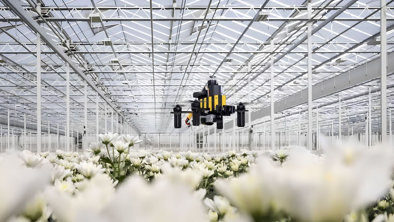
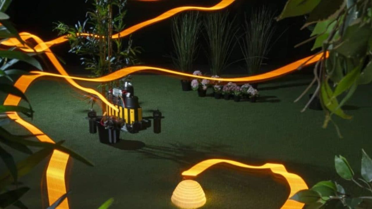
A new navigation system created by researchers from the Delft University of Technology in the Netherlands has enabled a drone to return on its own to the origin location without relying on GPS, digital maps, or high-capacity computers. The solution, called Bee-Nav, was developed from observing bee behavior and has already shown promising results in tests conducted in both indoor and outdoor environments.
The proposal aims to solve a common challenge in autonomous navigation: maintaining orientation even in places where positioning signals are unavailable or faulty. To achieve this, the scientists replicated a strategy similar to that used by these insects during their movements.
What motivated the development of the technology
The origin of the research lies in the orientation capability of bees. Despite the small size of their brains, these insects can move significantly away from their nests in search of food and then return to the point of origin with precision.
-
Robots Clean Solar Panels in Desert Power Plants Without Water, Preventing Energy Losses

-
AI Radar Built with Old Camera and $20 Gains Attention After Alleged $317,000 Sale to Chinese Government, But Lack of Documentation and Official Confirmation Raises Questions

-
Amateur Detectorist Discovers 3,400-Year-Old Bronze Age Gold Treasure with 121 Pieces in Transylvania, Including a Unique Ring

-
Italian Designer Develops Solar-Powered Terracotta Water Purifier Producing Up to 5 Liters of Drinking Water Daily Without Electricity


According to information released by the portal New Atlas, a bee can travel up to 3 kilometers during this search. Even so, it can find its way back without resorting to any tools similar to those used by humans.
This ability sparked the interest of scientists, who decided to investigate how this process could be adapted for robotic systems.
How the drone learns to locate itself
Instead of relying on external infrastructure, the equipment uses information collected from the environment around it.
Before starting a longer mission, the aircraft performs an initial reconnaissance of the area near the starting point. During this stage, it records visual references that will be used later.
These records are processed by a compact neural network, responsible for helping the system identify its relative position concerning the point of origin.
Additionally, the equipment continuously tracks the displacement made during the flight. The combination of these two sets of information allows estimating the route needed to return.
Low memory consumption is one of the drone’s differentiators
One of the aspects most highlighted by the researchers was the computational efficiency achieved by the system.
While various navigation technologies depend on large storage and processing capacity, the Bee-Nav operated with extremely reduced memory volumes.
The tests recorded numbers such as:
- 3.4 KB of memory in some demonstrations;
- Up to 42 KB in the most advanced experiments;
- Operation without complex onboard computers;
- Use of compact neural networks.
This result could open the way for the application of the technology in smaller and lighter equipment.
Results of the tests conducted
To evaluate the performance of the solution, the team subjected the system to different operational scenarios. The flights included indoor environments and outdoor areas, with routes exceeding 600 meters.
In indoor spaces, especially in large structures like hangars, the performance was considered fully satisfactory. However, in outdoor tests, factors emerged that directly influenced the result.
Wind conditions altered the aircraft’s behavior during displacement, affecting how visual references were perceived. Even in the face of this challenge, the success rate remained close to 70%.
The researchers highlight that the results demonstrate potential for future practical applications.
Where can the “bee drone” be used?
The autonomous navigation developed by the scientists can be useful in operations conducted in locations where GPS has limitations or is unavailable.
Among the applications mentioned by the team are:
- Monitoring of crops in enclosed environments;
- Inspection of industrial facilities;
- Logistical operations in storage centers;
- Monitoring of environmental areas;
- Coordination of autonomous aircraft groups.
Since the system requires few computational resources, there is an expectation that it can equip smaller platforms and operate more safely in locations close to people.
Besides the advances aimed at robotics, the study offers an opportunity to better understand how insects perform complex orientation tasks.
By artificially replicating strategies found in nature, scientists can analyze mechanisms that still spark interest in the academic community.
The research suggests that efficient solutions do not always depend on large computational structures. In some cases, observing how small organisms solve everyday challenges can indicate paths for the development of new technologies.
With information from Olhar Digital