
 Portuguese
  Spanish
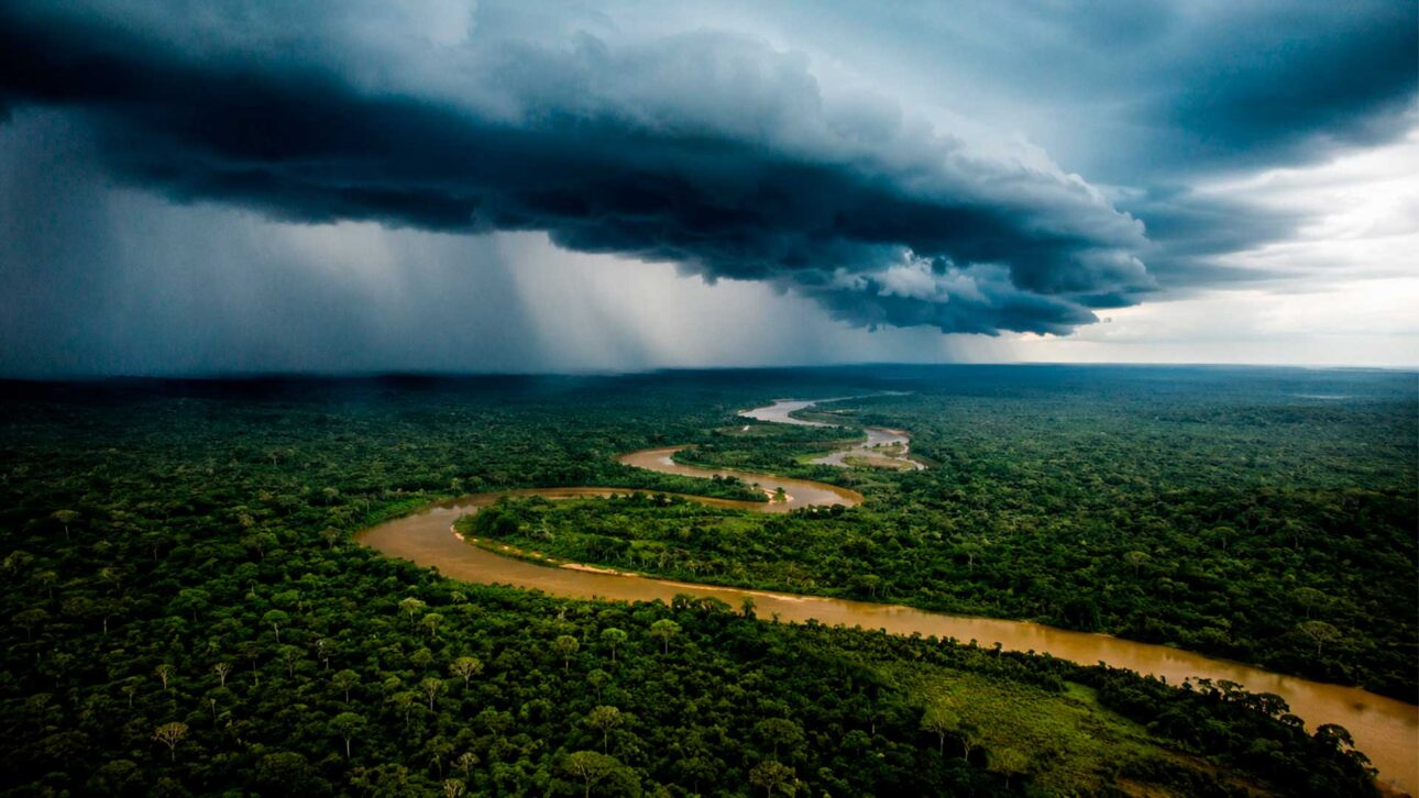
Study released in May 2026 shows that Brazilian forest areas still without formal protection occupy strategic points of the routes that transport moisture from the Amazon to the Andes
A new study has placed the public forests still without official designation at the center of an issue that goes beyond Brazil’s borders. These areas help maintain atmospheric corridors that carry water vapor from the Amazon to regions of Peru and Bolivia, where more than 70% of the annual precipitation in sensitive zones depends on these flows.
The survey was presented on May 28, 2026, by Amazon Conservation. Produced in the format of a technical report, the document mapped three seasonal routes of the so-called flying rivers and identified the points where deforestation, road openings, and forest fragmentation can compromise moisture circulation.
The analysis shows that the problem is not only in the total number of trees cut down. The location of forest loss also matters because certain corridors function as real bottlenecks through which moisture must pass before reaching the southwestern Amazon and the Andes Mountain Range.
-
Crab Trapped in Plastic Bottle for 62 Days Near Okinawa Highlights Little-Known Impact of Marine Pollution on Small Animals

-
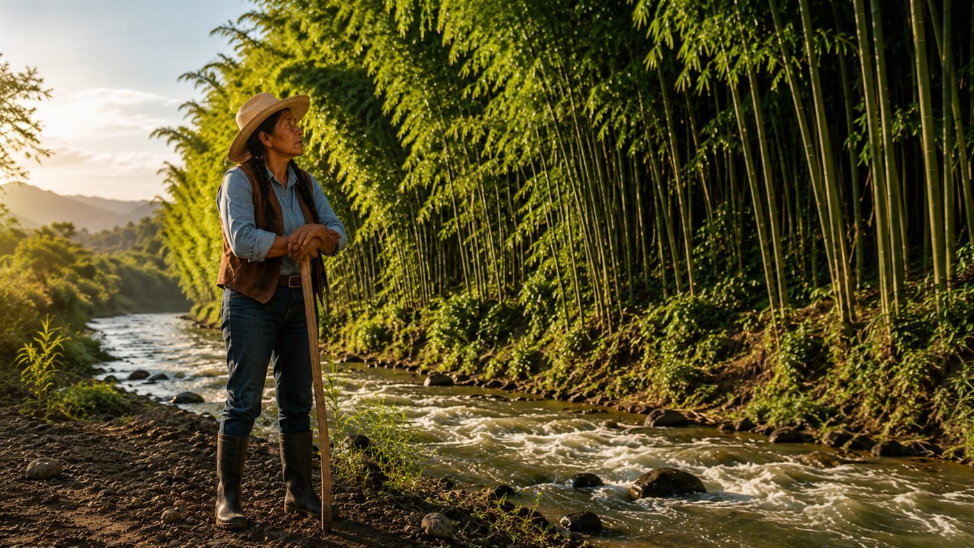
Esperanza’s Bamboo Barrier in Oaxaca Redirects River and Reduces Erosion by 85% in Five Years

-
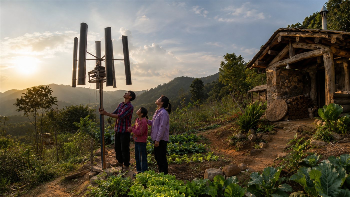
Family Builds Homemade Wind Turbine to Power Off-Grid Home, Video Reaches 555,000 Views on Ngô Thị Huyền’s Channel
-
Indian Brand Creates Sneakers from Recycled PET Bottles and Discarded Tires, Repurposing Over 1 Million Bottles and Raising $4 Million for Expansion


Acre appears as one of the most strategic areas, as it gathers the passage of the three identified routes. At the same time, part of this corridor crosses public lands that belong to the Union or the states but have not yet been transformed into conservation units, recognized territories or areas destined for sustainable use.
Flying rivers transport water from the Atlantic to the interior of the continent
Flying rivers are not visible watercourses like the rivers that run on the ground. They are large flows of vapor transported by winds, starting with the moisture that arrives from the Atlantic Ocean and being continuously fed by water evaporation and plant transpiration.
Trees draw water from the soil through their roots and release part of it into the atmosphere through their leaves. This process, known as evapotranspiration, helps recycle rain and allows moisture to continue advancing for thousands of kilometers over the continent.
The Ministry of Science, Technology, and Innovation has already highlighted that the Amazon vegetation produces vapor responsible for the formation of these corridors, influencing rainfall and energy security. Thus, the forest is not just an area that receives water but an active part of the climate infrastructure that redistributes this water.
Acre concentrates the three main moisture transport routes
The study worked with atmospheric circulation data, reverse trajectories of moisture, deforestation maps, land categories, and information on infrastructure works. The combination of these bases allowed the reconstruction of the likely path traveled by vapor before reaching the regions analyzed in Peru and Bolivia.
Three routes related to the rainy, dry, and transition periods were identified. They change position and intensity throughout the year but converge in areas of the western Amazon before advancing towards the Andes.
The dry season route was classified as the most vulnerable. During this period, the entry of moisture may be lower and the system becomes more dependent on water recycled by the vegetation itself, which increases the importance of maintaining continuous forest corridors.
Areas near infrastructure axes, including regions associated with the BR-319 and BR-364 highways, are also concerning. Roads do not directly eliminate flying rivers but can facilitate new occupations, illegal logging, fires, and the opening of agricultural areas along their zones of influence.
Forests without designation are more exposed to land grabbing and deforestation
Undesignated Public Forests are areas that already belong to the public authority but are still awaiting a decision on their definitive use. They may eventually be designated for conservation, sustainable management, recognition of traditional territories, or other categories provided for in legislation.
According to information from the Amazon Environmental Research Institute, these forests occupy approximately 50 million hectares in the Amazon biome and store about 5 billion tons of carbon. Even with this climatic, environmental, and water value, they remain especially vulnerable while they do not receive a formal definition.
The institute estimates that between 26% and 30% of Amazonian deforestation occurs in these areas. About 60% of their extent would also have some type of overlap with records from the Rural Environmental Registry, the CAR, although the declaratory registry is not a land ownership document.
These overlaps can be used to try to create an appearance of private occupation over public heritage. In practice, registration in the CAR does not transform public land into private property, but it can fuel land disputes, speculation, and processes of irregular occupation when there is no oversight and analysis of the registries.
A study published in the journal Nature Communications, based on 33 years of data, concluded that public lands without land tenure definition showed more deforestation than areas under some formal regime. The result indicates that defining the use and responsibility over the territory can reduce the uncertainty that favors invasions and clearings.
Loss of trees can weaken rain recycling
When the forest is replaced by pastures, crops, roads, or degraded areas, the ability to return water to the atmosphere tends to decrease. The soil can also become warmer, while fragmentation alters local air circulation and the way moisture moves across the landscape.
This does not mean that cutting an isolated area will immediately stop all rain in another country. Atmospheric systems are complex and are also influenced by ocean temperatures, phenomena like El Niño and La Niña, and global warming.
The risk pointed out by the study appears with the accumulation of forest losses along strategic corridors. The more fragmented the path, the lower the efficiency of water recycling may be, especially during the dry season, when the contribution of vegetation becomes more important.
Drought of 2023 and 2024 showed the extent of possible impacts
The report uses the drought that hit the Amazon between 2023 and 2024 as an example of the exposure of populations, rivers, and economic activities to a prolonged reduction in rainfall. The authors do not claim that Brazilian deforestation was the sole cause of that event, which involved different climatic factors.
The World Meteorological Organization recorded that the Amazon and the Pantanal had, in parts of 2024, precipitation between 30% and 40% below normal. The Rio Negro, in Manaus, reached a new low record that year, surpassing the minimum level that had already been recorded in 2023.
In the southwest of the continent, the lack of rain affected agricultural crops, forest production, and water availability. The document cites a reduction of up to 75% in soybean production in Santa Cruz, Bolivia, as well as a decrease in potato harvest in the Puno region, Peru.
The effects also reached navigation, riverside communities, hydroelectric generation, and chains associated with the forest, such as nut production. Water security, food production, and the conservation of the Amazon are linked to the same moisture circulation system.
Protection of strategic areas requires land and environmental decisions
Among the proposals presented is the creation of the concept of Critical Moisture Territories. These would be areas where vegetation plays a particularly important role in recycling and transporting vapor and should therefore be prioritized in conservation and land-use planning decisions.
Researchers also advocate that the impact on flying rivers should be considered in the licensing of large infrastructure projects. A project located in Brazil can stimulate land use changes capable of affecting rain, agriculture, and ecosystems in regions situated in neighboring countries.
Another recommendation is to accelerate the allocation of public forests, restore degraded areas, and strengthen existing programs. The Ministry of the Environment reports that Planaveg 2025-2028 is part of Brazil’s goal to recover 12 million hectares of native vegetation by 2030, while initiatives like the Amazon Protected Areas Program can support the expansion and consolidation of conserved areas.


