Portuguese
  Spanish
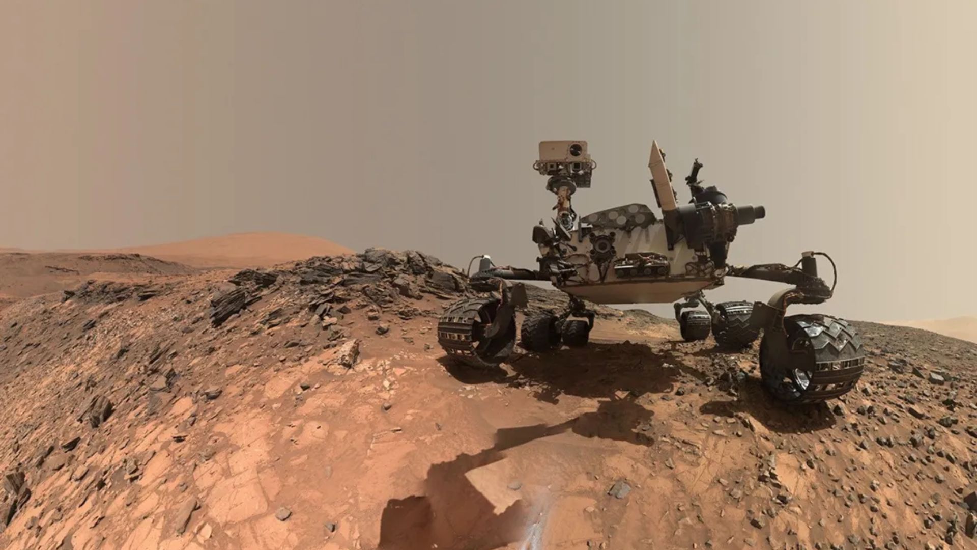
Mars Global Localization Technology Allows the Perseverance Rover to Pause Navigation, Redefine Its Location with an Error Margin of Only 25 Centimeters, and Resume Its Course Without Relying on Operators on Earth
The planetary rover Perseverance, from NASA, has reached a new level of autonomy by determining its own location on the surface of Mars without relying on commands sent by human operators on Earth. This change represents a significant advancement in robotic space exploration and marks a turning point in how planetary vehicles move in extraterrestrial environments.
This unprecedented capability is a direct result of implementing Mars Global Localization technology, developed by the Jet Propulsion Laboratory. The information was disclosed by the space agency itself, as stated in a technical release issued after the first operational tests of the system on Martian soil.
Until then, even being one of the most sophisticated robots ever sent to another planet, Perseverance still relied heavily on analyses conducted on Earth to confirm its exact position and plan safe routes. With the new technology, this dependence is beginning to be eliminated, paving the way for faster, more efficient missions that are less susceptible to human error.
-
Scientists Develop Innovative Material That Converts Visible Light to Ultraviolet, Unlocking New Possibilities for Optical Equipment and Advanced Communications

-
2011 Japan Earthquake Sent Seismic Waves to Earth’s Core, Returning in 15 Minutes and Shifting Entire Country Simultaneously, Scientists Reveal

-
NASA captures heart-shaped pink lagoon in Argentina’s salt flats
-
To Aid Mars Missions, 12 Volunteers to Spend 60 Days in Bed Without Getting Up, Earning €18,000 in Study Starting 2026


How the Mars Global Localization System Works on Mars
Unlike terrestrial GPS, which relies on a network of orbiting satellites, Mars does not have a similar global positioning system. Therefore, Mars Global Localization was designed to operate completely independently, utilizing resources already available on board the rover.
The system works through an advanced algorithm that compares panoramic images captured by Perseverance’s navigation cameras with detailed orbital maps stored in its internal memory. By cross-referencing this data, the rover can identify reference points on the Martian terrain and calculate its position with extreme precision.
This processing is carried out on a high-performance processor, originally used for communication with the Ingenuity helicopter, the first aerial vehicle to fly on another planet. The complete calculation takes about two minutes to complete and achieves an approximate accuracy of 25 centimeters, an impressive leap compared to previous methods.
The technology was first employed in regular operations on February 2 and was used again on last Monday (16), demonstrating stability and reliability in real exploration conditions.
Old Limitations and the Issues with Visual Odometry
Prior to adopting Mars Global Localization, Perseverance mainly relied on what is known as visual odometry, a method that estimates the rover’s position based on the sequential analysis of images of the terrain during movement. Although efficient in short trips, this technique had significant limitations over longer distances.
Over time, small accumulated errors in this type of estimate could result in uncertainties of several meters. This deviation forced the team on Earth to intervene frequently, manually correcting the robot’s position and adjusting its routes, which severely limited the vehicle’s autonomy.
Additionally, the natural delay in communication between Earth and Mars—which can be several minutes—made these interventions slow and operationally costly. As a result, many movements had to be halted or shortened for safety reasons.
The Impact of Autonomous Navigation on the Future of Space Exploration
With this new capability, Perseverance can now interrupt its course on its own, recalculate its position with greater accuracy, and resume autonomous navigation, without waiting for human instructions. According to NASA, this update significantly expands the potential for independent movements and is expected to increase the overall efficiency of operations on the Red Planet.
In practice, this means that the rover will be able to cover greater distances in less time, explore more complex areas, and conduct scientific experiments with less dependence on constant oversight from Earth. This is a crucial advancement for future missions, especially those involving multiple robots or preparing for human presence on Mars.
Furthermore, Mars Global Localization technology could serve as a foundation for similar systems on other celestial bodies, such as the Moon, asteroids, and the moons of Jupiter and Saturn. The idea of a true “Martian GPS,” once seen as an analogy, now represents a concrete technical reality in modern space exploration.
Source: CNN Brazil