Portuguese
  Spanish
Forecast indicates extreme climatic scenario with generalized instability, above-average heat, and risks ranging from South to North, requiring increased attention from the population
The week begins with a worrying climatic scenario in Brazil. This is because, simultaneously, different regions of the country are on alert due to the combination of intense storms, extreme heat, and large thermal variation, a phenomenon that can directly impact millions of Brazilians in the coming days.
This information was released by the National Institute of Meteorology (Inmet), according to recent analyses from the agency, which point to a period of strong atmospheric instability. According to the institute, warnings for intense rains and storms are already active, covering from the South region to the North, as well as areas in the Northeast and the Midwest.
Storm warnings spread across the country, affecting various regions simultaneously
Initially, one of the most notable points is the yellow alert for “potential danger”, which is already in effect for states such as Rio Grande do Sul, Santa Catarina, as well as areas in southern Paraná and Mato Grosso do Sul.
-
Rare fox feared “extinct” found alive on Caribbean island after over two decades without official sightings

-
21-Year-Old Brazilian Student Turns Homemade Popsicle Hobby into $100,000-a-Month Business

-
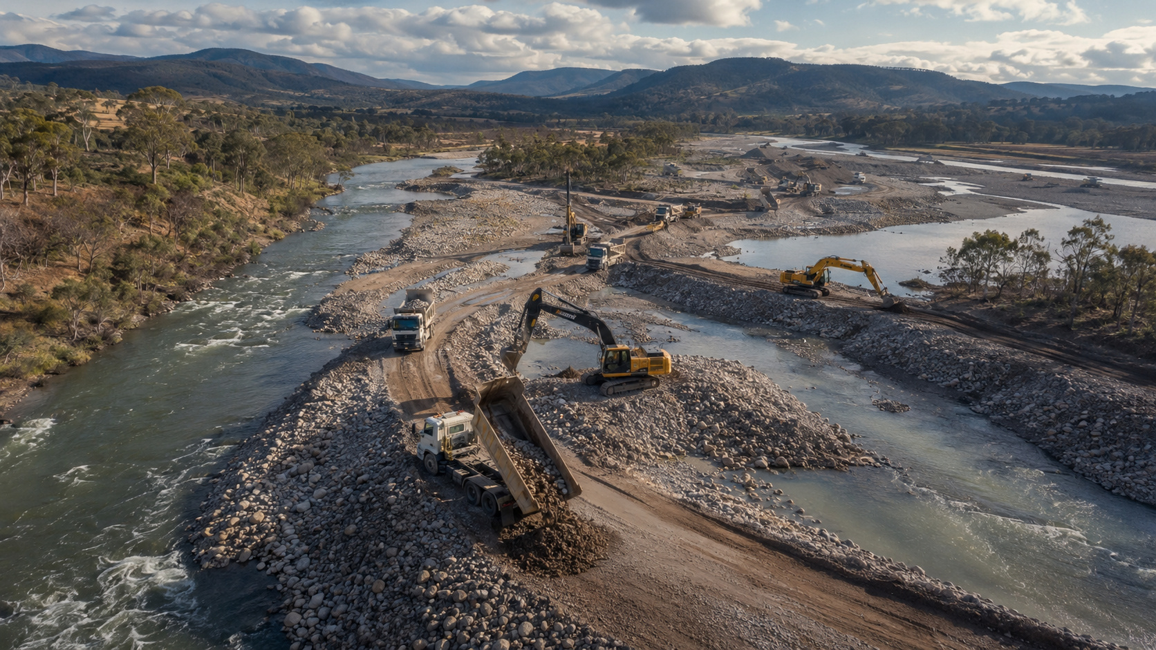
Australia Dumps Hundreds of Thousands of Tons of Gravel into Rivers to Restore Natural Barriers and Reverse 150 Years of Erosion

-
Bird-Inspired Robot Glides on Air Currents up to 10 m/s, Balances Itself, and Aims to Save Energy in Industrial Inspections and Meteorological Balloons


In these regions, the forecast indicates rains between 20 mm/h and 30 mm/h, potentially reaching up to 50 mm per day. Additionally, winds are expected to vary between 40 km/h and 60 km/h, which increases the risk of disruptions, even if considered of low intensity.
On the other hand, although the risk is classified as moderate, experts warn of possible occurrences such as falling tree branches, localized flooding, interruptions in electricity supply, and electrical discharges. In other words, even without an extreme scenario, the impacts can be felt in the daily lives of the population.
At the same time, another yellow alert covers almost the entire North region, as well as the state of Mato Grosso and parts of the Northeast coast. In some of these locations, the situation is even more critical, as the level of attention rises to orange alert, indicating more intense rains and a greater risk of severe events.
Furthermore, there is a specific warning for high accumulated rainfall in Espírito Santo and southern Bahia, with areas that may face more significant volumes of precipitation, raising the level of concern.
Intense heat and thermal variation amplify the feeling of extreme weather in the country
Despite the storms, another factor draws attention and reinforces the atypical climatic scenario: the heat. Even with the presence of instabilities, temperatures remain high in much of the national territory.
According to meteorological analyses, the month of April is already showing temperatures above the historical average, especially in the Central-South regions. States such as São Paulo, Minas Gerais, Goiás, and Mato Grosso do Sul are expected to continue experiencing hot days.
In addition, a specific phenomenon contributes to this feeling of extreme weather: the thermal amplitude. This occurs when there is a significant difference between the minimum and maximum temperature throughout the day.
In practice, a cold air mass acts in the early hours of the morning, bringing milder temperatures. However, throughout the afternoon, the warming intensifies rapidly, causing thermometers to rise significantly.
As a result, in various areas of the interior of the country, temperatures may approach 38°C by the end of the week, a level considered high for the period.
Safety recommendations gain importance in light of the risk of storms
In this scenario, authorities emphasize the importance of adopting preventive measures. After all, even though many alerts are classified as lower risk, the combination of climatic factors can create dangerous situations.
Inmet advises that, during gusts of wind, the population avoid taking shelter under trees, as there is a risk of falling branches. Additionally, it is recommended to not park vehicles near metal structures or vulnerable areas.
Another essential point is to avoid using electronic devices plugged into the outlet during storms, thus reducing the risk of damage caused by electrical discharges.
In emergency situations, citizens should contact Civil Defense at phone number 199 or Fire Department at number 193, ensuring quick and appropriate assistance.
Therefore, in light of this scenario that combines heavy rains, strong winds, and extreme heat, the main recommendation is to stay informed and attentive to weather updates. After all, the weather in the coming days may bring surprises — and being prepared makes all the difference.