Portuguese
  Spanish
YaraTracker combines satellite images and AI to identify bodies of water and aquaculture areas with unprecedented accuracy. Discover the innovation from Embrapa.
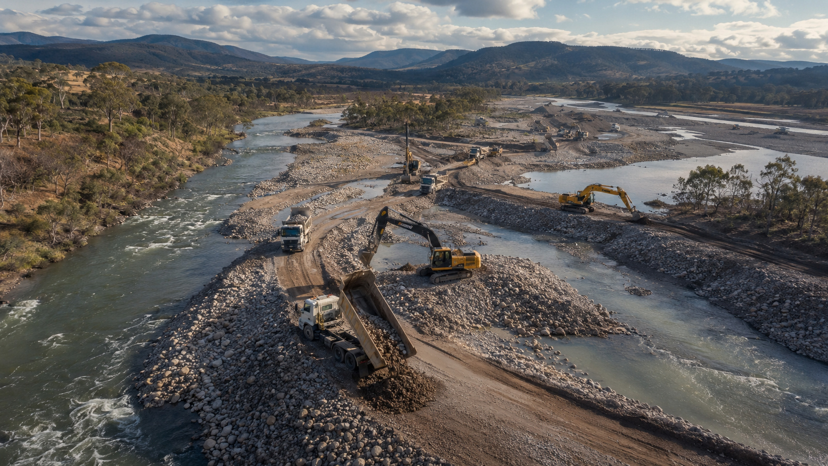
With an accuracy rate of up to 97% in identifying fish production areas, Embrapa’s new system, named YaraTracker, emerges as a revolutionary tool for the sector. The solution, which integrates satellite images and AI, was developed to automatically locate and classify various bodies of water throughout Brazilian territory. Through this technology, researchers and public managers can differentiate, with high technical rigor, natural reservoirs from structures aimed at aquaculture, facilitating national water management.
Results and accuracy of satellite mapping
Tests conducted by Embrapa show that the project’s artificial intelligence already operates at efficiency levels exceeding international standards. The orbital analysis process is carried out in successive stages to ensure that the final result is as faithful as possible to the Brazilian geographical reality.
The current performance of the system is divided as follows:
-
Entrepreneur Turns Rio Cemetery Canteen into a Successful Snack Chain Generating $4.9 Million Annually and Expanding to Metro Stations

-
Rare fox feared “extinct” found alive on Caribbean island after over two decades without official sightings

-
21-Year-Old Brazilian Student Turns Homemade Popsicle Hobby into $100,000-a-Month Business

-
Scientists Convert Food Waste into Aviation Fuel, Successfully Test 50% Blend with Conventional Kerosene to Cut Emissions and Promote Sustainable Flights


- Initial identification: The software detects the presence of water in images with 90% accuracy.
- Formation of structures: The AI groups water regions to form complete rivers and lakes with 84% accuracy.
- Productive classification: The system distinguishes aquaculture farms from other types of water with 97% accuracy.
Although it shows excellent performance in not overlooking production areas, the project is still undergoing refinements. The current goal is to reduce the occurrence of “false positives,” which happens when the tool confuses common water bodies with aquaculture systems.
New system from Embrapa and Concert Space uses satellite images and AI
One of the pillars of YaraTracker is the partnership with Concert Space, which aims to implement data processing directly in space. This evolution will allow only the already analyzed and filtered information to be sent to ground bases, optimizing response time and the efficiency of water monitoring.
The strategic potential of this innovation was reinforced by Concert Space CEO, Rafael Mordente:
“This initiative represents an important advancement in the use of digital technologies for environmental monitoring and aquaculture production in Brazil. YaraTracker is a robust tool capable of providing strategic information for the planning and monitoring of aquaculture production and the use of water resources.”
In addition to agility, the platform should also incorporate features that allow users to filter results by the size of the detected reservoirs, offering personalized control of the mapping.
Resource Management and Public Policies
The technological foundation of YaraTracker utilizes the concept of Software Defined by Satellite (SDS) to read data from constellations such as Sentinel, Landsat, and CBERS.
Embrapa projects that by consolidating this system that combines satellite images and AI, it will be possible to offer unprecedented support for decision-making in agribusiness and environmental conservation.
In the current phase, the institution focuses on validating the performance of the tool in different regions of the country. Since Brazil has a vast diversity of productive profiles and land structures, testing AI in varied territorial contexts is essential.
Therefore, by transforming photos from space into reliable statistical data, the initiative addresses a historical lack of detailed information about aquaculture infrastructure in the country. With the completion of the tests, it is expected that YaraTracker will become a permanent operational platform for monitoring Brazilian production and natural resources.
With information from Embrapa