Portuguese
  Spanish


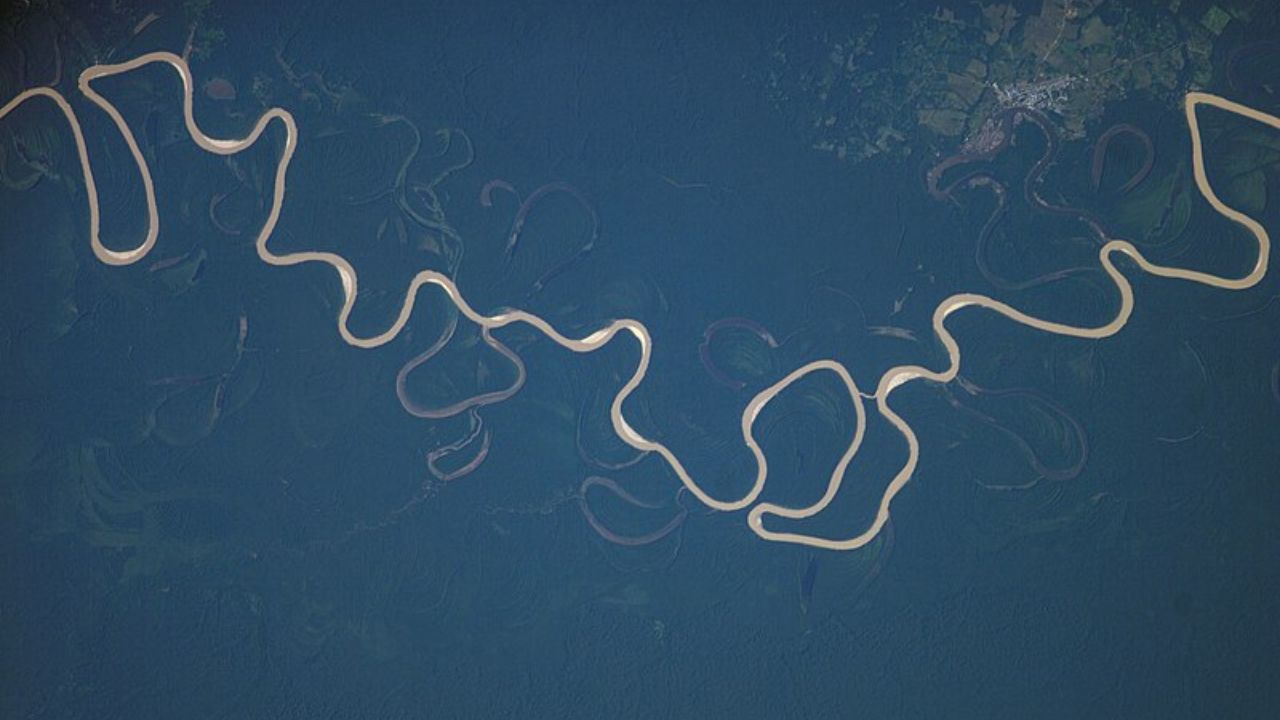


With an area approaching 7 million square kilometers, the Amazon River system extends through nine countries and holds the highest water potential on the planet, shaping the climate and life on the continent.
The Amazon Basin is the largest and most powerful river basin on the planet. Its monumental scale influences ecosystems, sustains millions of people, and regulates global climate processes. Understanding its architecture, from geological origins to its complex river network, is essential to comprehending its relevance to Brazil and the world.
Geography and Water Potential of the River Basin
The Amazon Basin occupies a colossal area. Estimates of its extent range from 6.74 to 7.05 million square kilometers. This territory corresponds to about 42% of the entire area of Brazil and nearly one-third of South America.
Its nature is transnational, being a resource shared by nine nations. Brazil holds the largest share (63%), followed by Peru, Bolivia, Colombia, Ecuador, Venezuela, Guyana, Suriname, and the territory of French Guiana.
-
Tourist Discovers Forgotten Joaquín Sorolla Painting Worth Up to 60,000 Euros While Strolling in Seville

-
Brazil’s Fernando de Noronha Boasts World’s Most Beautiful Beach, Accessible Only by Descending 208 Cliffside Steps and With No Food Vendors Allowed

-
Wave Rock: Australia’s Giant Granite Wave Stands 15 Meters Tall, Spans 110 Meters, and Showcases 2.7 Billion Years of Erosion in the Australian Desert
-
How to Unclog Showerhead Holes Blocked by Limescale and Hard Water Without Replacing or Hiring a Technician


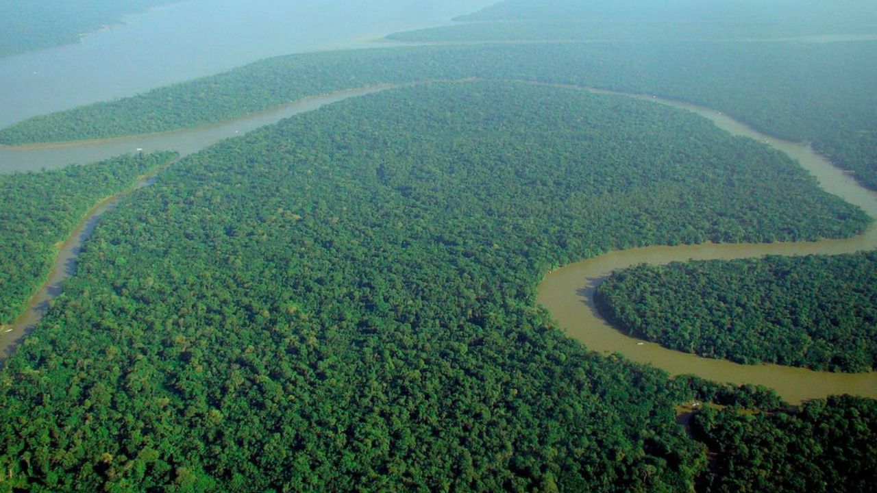
The water potential of the Amazon is unparalleled. The Amazon River discharges approximately 20% of all the liquid freshwater that rivers around the world provide to the oceans into the Atlantic Ocean. During peak rainy season, its flow can reach an extraordinary 290,000 cubic meters per second.
Its hydrological regime is mixed, fed by both equatorial rain and meltwater from the Andes Mountains. A fundamental characteristic is its trans-equatorial drainage, receiving tributaries from both the Northern and Southern Hemispheres. This arrangement stabilizes the flow of the main river, as flooding from tributaries in each hemisphere occurs at different times, ensuring a considerable water volume throughout the year.
How the Andes Inverted the Flow of a Continent
The current Amazon landscape is the result of a dramatic geological history. The most accepted theory states that, in the past, the Amazon river system flowed in the opposite direction, towards the Pacific Ocean. The uplift of the Andes Mountains, which began about 65 million years ago, blocked this outlet.
This monumental barrier dammed the waters, forming a gigantic inland lake. Over time, erosion and drainage capture on the Atlantic side completely inverted the river’s flow, which began to flow eastward. The Andes thus not only created the river’s source and its main sediment source but also formed the vast plain we know today.
This plain has an extraordinarily gentle slope. In the Brazilian section, over 3,000 km, the drop is only 15 meters. This characteristic explains the slowness of its waters and the phenomenon of the “flood pulse”, the ecological engine of the basin that fertilizes the floodplains and governs the life cycles of the fauna.
The Arteries of the River Basin
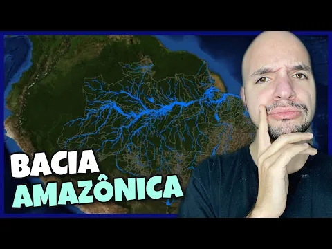
The Amazon Basin is a network of over 7,000 tributaries. The Amazon/Solimões River is the backbone. Nearly 7,000 km long, it is recognized as the longest and largest river in the world. Its murky waters are classified as “white waters” due to the high sediment load from the Andes.
The Rio Negro is the largest tributary on the left bank and the largest “black water” river in the world. Its dark color comes from humic acids from the decomposition of organic matter. Its waters are acidic and nutrient-poor. The confluence of its waters with those of the Solimões creates the famous “Meeting of Waters”, near Manaus.
The Rio Madeira is the main tributary in terms of water volume and sediment. It is also a “white water” river, responsible for the phenomenon of “fallen lands”, the constant erosion of the banks. Meanwhile, the Rio Tapajós is an example of “clear waters”, with a greenish color due to its low sediment content.
This distinction between water types is a geochemical signature that organizes biodiversity throughout the river basin.
Know the Grand Amazon Aquifer System (SAGA)
Under the network of surface rivers lies an invisible giant: the Grand Amazon Aquifer System (SAGA). This underground water reservoir has an estimated volume of over 160,000 cubic kilometers, four times that of the Guarani Aquifer.
The SAGA is already a vital resource, used for supplying cities like Manaus and Santarém. It serves as a strategic reserve, but its health is linked to that of the forest, which is crucial for its recharge. Deforestation and surface contamination pose a serious threat to this underground ocean.
The Vital Role of the Forest and Rivers

The Amazon is the epicenter of terrestrial biodiversity, housing at least 10% of all known species. The diversity of fish is the highest on the planet, with over 2,700 species cataloged, 62% of which are endemic, meaning exclusive to the region.
In addition to being a repository of life, the basin acts as a climate engine. The forest stores between 80 and 120 billion tons of carbon. More importantly, it releases colossal amounts of water vapor into the atmosphere through evapotranspiration, forming the so-called “flying rivers”.
These atmospheric rivers are carried by winds, irrigating vast areas of South America, including the Midwest and Southeast of Brazil, regions that concentrate 70% of the continent’s GDP. Deforestation directly threatens this mechanism, with the potential to affect the water and food security of millions of people.
The Challenges for the Survival of the River Basin
The Amazon Basin is home to about 30 million people and the stage for intense socio-environmental conflicts. The advance of deforestation, driven mainly by cattle ranching, agriculture, and illegal mining, is the most visible threat.
Illegal mining, in particular, dumps tons of mercury into rivers, contaminating the food chain and causing severe neurological damage to riverside and indigenous populations.
Another major challenge is the expansion of hydroelectric dams. Although viewed as a source of energy, the dams in the Amazon flood vast areas of forest, releasing greenhouse gases and fragmenting the connectivity of rivers. This fragmentation blocks fish migration and the passage of sediments that fertilize the plains, threatening the foundation of the ecological functioning of the entire river basin.