
 Portuguese
  Spanish
New geological evidence associates the origin of the Euphrates with two ancestral rivers that changed course over millions of years, in a process that helps explain the formation of one of the main river basins linked to ancient Mesopotamia.
A study published in the journal Nature Geoscience indicates that the Euphrates River, cited in biblical tradition as one of the watercourses associated with the Garden of Eden, was formed from the reorganization of two large ancient river systems.
According to the research, the Paleo-Karasu and Paleo-Murat rivers drained into the eastern Mediterranean about 5.5 million years ago, before tectonic changes redirected their courses towards the Persian Gulf.
The investigation was conducted by an international team led by geologist Andrew Madof from Chevron, with participation from researchers linked to the University of Oxford, including Claudia Bertoni and Richard Walker.
-
Texas Teens Win $50,000 at World’s Largest Science Fair for Developing Non-Surgical Brain-Controlled Bionic Prosthesis with 98% Accuracy

-
Samsung Galaxy A27 Launches with 6.7-inch Super AMOLED Display, Full HD+ Resolution, Android 16, Six Years of Updates, Snapdragon 6 Gen 3, and Dust and Splash Resistance; Available for Pre-order in the US for $350

-
Five Brazilian Students Invent Drug Test Pen That Detects Date Rape Drugs in Seconds
-
Viedma Glacier Retreat in Patagonia Uncovers 900-Meter-Deep Basin, Making Viedma the Deepest Lake in the Americas


To reconstruct the trajectory of these ancient rivers, the authors combined seismic reflection data, geomorphological mapping, and sediment modeling, a methodology used to analyze watercourses that no longer exist in the same configuration.
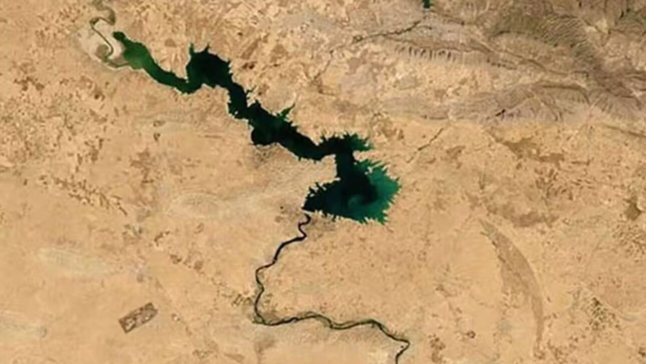
Currently, the Euphrates crosses Turkey, Syria, and Iraq and, alongside the Tigris, forms the river system linked to Mesopotamia, a region historically associated with the development of ancient agricultural areas and urban centers.
In historical and archaeological literature, Mesopotamia is linked to the Fertile Crescent, an area where environmental conditions favored the expansion of agriculture, the formation of cities, and the organization of complex societies.
Origin of the Euphrates River was traced by seismic data
The investigation advanced from data collected in 2014, when seismic surveys conducted off the coast of Lebanon identified signs of ancient river deposits over thick layers of salt at the bottom of the Mediterranean.
According to the researchers, these records drew attention because they did not match the expected pattern for an area currently submerged and distant from large modern rivers that could explain the presence of this type of sediment.
The analyzed salt layers are associated with the Messinian Salinity Crisis, a geological episode that occurred between approximately 5.97 million and 5.33 million years ago, when the Mediterranean underwent significant environmental changes.
During this interval, geological studies indicate that the Mediterranean experienced intense evaporation and its level was drastically lowered, with parts of the seabed exposed or partially isolated at certain times.
By comparing the buried sediments with known formations on land, the team associated these materials with two ancient river systems, identified as Paleo-Karasu and Paleo-Murat.
The Paleo-Karasu appeared as a northern branch, while the Paleo-Murat occupied a more southern position, both related to rivers that today form the headwaters of the modern Euphrates.
Paleo-Karasu and Paleo-Murat were giant rivers
The modeling presented in the study indicates that these ancient rivers had dimensions larger than the current watercourses in the region, considering parameters such as flow and sediment transport.
According to the estimates cited by the researchers, the Paleo-Karasu would have surpassed the modern Nile, while the Paleo-Murat would have been larger than the current Tigris and Euphrates rivers combined.
Despite their size, the two systems did not maintain drainage to the Mediterranean for a long period during the phase of greatest exposure of the basin.
According to National Geographic, the rivers would have flowed into the then dehydrated area of the Mediterranean for about 120,000 years, a period considered short when observed on the geological scale.
After this period, the landscape configuration underwent gradual changes associated with the region’s tectonic activity.
Geological faults, earthquakes, and landform formation processes would have displaced sections of the rivers and altered the direction of flow over millions of years.

According to the published reconstruction, the Paleo-Murat changed course first, around 3.6 million years ago, while the Paleo-Karasu would have been redirected about 800,000 years later.
Tectonic changes formed the modern Euphrates
With the change in drainage direction, the two systems stopped feeding the eastern Mediterranean and began to flow southeast.
The reconstruction presented in the study indicates that the union of these courses gave rise to the Euphrates system, which was already flowing towards the Persian Gulf around 1.6 million years ago.
This model helps explain why ancient fluvial deposits appear over salt layers in the Mediterranean, even without major current rivers flowing into that specific area.
The research also adds data to the analysis of the evolution of the terrain in western Asia, in a phase prior to the development of human societies that would later occupy Mesopotamia.
Andrew Madof told Live Science that the modern landscape on land and the sediments buried at sea preserve signs of the ancient Euphrates.
In an explanation of the methodology, the researcher compared the work to tracking buried “footprints” of the river offshore and connecting them to the points where these traces reappear on land.
Discovery expands data on Mesopotamia
The research deals with the geological origin of the Euphrates and the reorganization of drainage systems that preceded human occupation of Mesopotamia.
By describing how tectonics altered water circulation in the region, the study relates long-term geological processes to the formation of environments that were later occupied by human populations.
Richard Walker, co-author of the study at Oxford, stated that the work highlights the role of tectonics in the development of the Fertile Crescent.
According to him, without the reorganization of the Euphrates’ course and its change of direction from the Mediterranean to the Persian Gulf, the regional environment could have presented a different configuration.
The interpretation also fits into scientific debates about the Messinian Salinity Crisis.
For decades, researchers have discussed to what extent the Mediterranean dried up, how the basin received fresh water, and how its salt deposits formed on such a large scale.
According to Angelo Camerlenghi, a researcher at the National Institute of Oceanography and Experimental Geophysics in Italy, interviewed by National Geographic, the new data may contribute to this scientific discussion.
The authors themselves note, however, that the reconstruction involves margins of uncertainty, as it relies on computational modeling, seismic images, and remote evidence, not just direct field samples.
Euphrates appears in biblical tradition and geology
The association of the Euphrates with the Garden of Eden comes from the book of Genesis, which mentions the river among the four watercourses linked to the paradise narrative.
In the book of Revelation, the Euphrates also appears in a passage about its drying up before an eschatological battle, a reference that appears in later religious interpretations about the river.
The study, however, does not seek to confirm religious interpretations nor locate the Garden of Eden.
The contribution presented by the researchers is in the field of geology, with the reconstruction of how ancient rivers shaped the landscape of the Middle East before the first known civilizations in the region.
Based on the evidence analyzed, the team proposes that the history of the Euphrates began with two separate rivers, diverted by tectonic forces and later reunited into a new river system.
This process, occurring over millions of years, is among the geological elements used to explain the formation of the river network that crosses western Asia.


