Portuguese
  Spanish
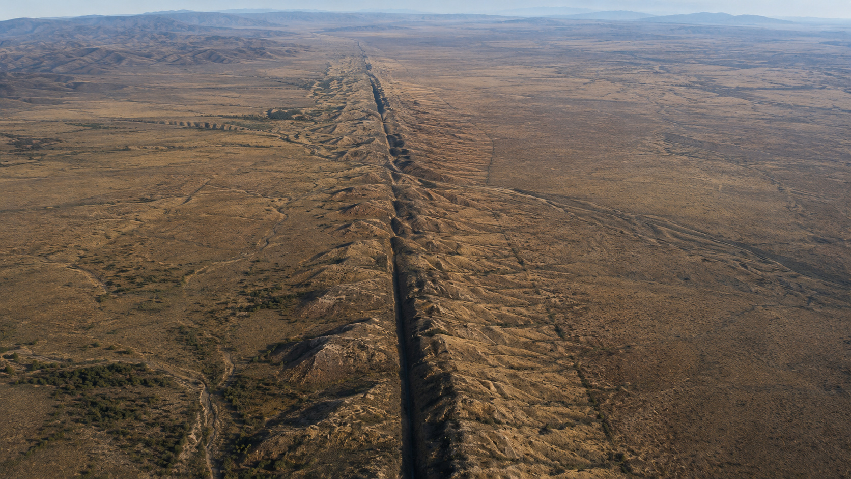
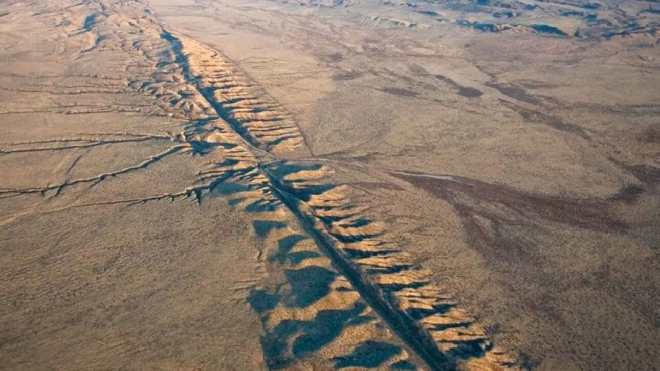
Researchers closely monitor the California region, where the constant friction between tectonic plates is accumulating seismic energy at a rate that concerns experts in geology and physical geography
For decades, geologists and seismologists have been paying close attention to one of the most monitored regions on the planet: the San Andreas Fault on the west coast of the United States. Recently, a warning has gained traction among experts — the area currently accumulates the highest seismic tension recorded in the last thousand years, a factor that reignites the debate about the so-called “The Big One,” the mega-earthquake that, according to scholars, could hit California at any moment.
According to explanations shared by Professor Ricardo, a specialist in physical geography, this accumulated tension does not mean that a major earthquake will necessarily occur tomorrow, next year, or even in the coming decades. However, the geological phenomenon behind this energy accumulation is real, measurable, and constantly monitored by scientists around the world.
How the process that generates earthquakes in California works
To understand why California is one of the regions most susceptible to major seismic shocks on the planet, it is necessary to go back to the very formation of the Earth. In this sense, the planet originated from a highly heated magmatic material, similar to lava, which gradually cooled and formed a rigid outer crust: the lithosphere. Over time, this rocky layer fragmented into various blocks, known as tectonic plates, which today support continents, oceans, and all life on the surface.
-
Brazil Advances with 14-X Hypersonic Project to Achieve Speeds Over Mach 5, Surpassing Concorde, After Two Decades of Research

-
Archaeologists Uncover 1,200-Year-Old Gold Treasure in Saudi Arabia, Ownership Remains a Mystery

-
Brazilian Startup Converts Tucumã Seeds into Bioplastic for Bicycle Pedals, Cups, and Construction Materials

-
NASA Captures Rare Encounter of South Korean “Surfboard” Spacecraft Crossing Lunar Orbit at Over 11,000 km/h


Meanwhile, just below the lithosphere, there is a layer of magma in constant motion, driven by the so-called convection movement: the material closest to the Earth’s core heats up and rises, while the more distant magma cools and sinks, creating a continuous cycle of circulation. As the tectonic plates “float” on this moving layer, they also slowly shift over time — a process called tectonism.
These shifts can occur in three different ways. In the first case, the plates collide in a convergent movement, giving rise to mountain ranges like the Andes, the Alps, or the Himalayas. In the second, the plates move away from each other in a divergent movement, as occurs in the middle of the Atlantic Ocean, where magma fills the empty space and forms the Mid-Atlantic Ridge. The third type — precisely what occurs in California — is the transform or sliding movement: instead of colliding or separating, the plates slide laterally relative to each other, generating constant friction between the Pacific Plate and the North American Plate.
The San Andreas Fault and the “Seismic Gate” of Cajon Pass
On the other hand, this continuous friction between plates does not happen smoothly. Some rocks can slide without major issues, while others get stuck, accumulating tension over decades or centuries, until the energy is suddenly released in the form of an earthquake. It is precisely this dynamic that explains the existence of faults like San Andreas and San Jacinto, both located in the region.
Between these two faults, there is an area known as Cajon Pass, which functions as a kind of natural “seismic gate.” In practice, this region usually prevents the energy released in one fault from directly propagating to the other. However, when the energy release occurs simultaneously or very similarly in both faults, the result can be a much broader seismic expansion — and consequently, an earthquake of even greater magnitude.
Historically, the region has recorded seismic shocks above magnitude 7 on the Richter scale, including a famous earthquake that occurred in the 19th century, south of the San Andreas Fault. For comparison, recent earthquakes in Venezuela ranged between magnitude 7.1 and 7.5 — numbers that help gauge the destructive potential of a shock of this scale, especially in a region like California, one of the most populous and wealthiest states in the United States, very close to Los Angeles.
Given this scenario, the main concern of experts is precisely the continuous accumulation of tension in rocks that have not yet slid. The longer this energy remains accumulated, the greater the potential for sudden release — which can generate not only the main shock but also subsequent aftershocks, capable of causing new damage even after the first major earthquake.
Even so, it is important to reinforce an essential point raised by the experts themselves: there is currently no scientific technology capable of accurately predicting when a major earthquake will occur. The interval can be one year, five years, fifty years, or even more than a century — a period that, although it seems long on a human scale, represents very little within the planet’s geological history.
Therefore, the recommendation from experts is not alarmism, but rather preparation. Investments in earthquake-resistant infrastructure, well-structured evacuation plans, and educating the population from school age on how to act during an earthquake are pointed out as the main ways to reduce the damage of a potential megathrust earthquake in the region. It is also worth noting that, according to the researchers themselves, the current level of seismic activity on the planet is essentially the same as observed thousands of years ago, which rules out any direct relationship between this specific phenomenon and climate change or human interference in terrestrial tectonics.