Portuguese
  Spanish
Global Google Tool Changed The Way We Move Around The World, Combining Satellites, Cars, Artificial Intelligence, And Users To Map Even The Most Secret Locations.
Google Maps is today one of the most indispensable tools in the digital everyday life, guiding millions of people in their routines, travels, and urban explorations.
However, few know the behind-the-scenes of this complex technology, which started modestly with cars equipped with heavy cameras and evolved into a powerful network of real-time geographic data.
In a video published on the channel Unknown Facts, fascinating details are revealed about how Google transformed its initial ambition of organizing the world’s information into a highly accurate global navigation platform.
-
Archaeologists Discover 2,500-Year-Old Tomb with Intact Ceremonial Chariot, Elite Weapons, and Bronze Vessels, Unveiling a Larger Picene Aristocratic Core Than Previously Thought

-
Experiment Shows Sea Water-Treated Ice Resists Melting Better from May to September

-
What Seemed Like Drizzle on Radar Was Actually a Swarm of Ants: Heatwave Causes Massive Swarms to Appear in UK Skies, Surprising Meteorologists
-
Pacific Ocean’s Garbage Patch Now Larger Than France, Covering 1.6 Million km², Accumulating Millions of Tons of Plastic and Posing an Invisible Threat to Marine Life


History Of Google Maps And Its Technological Creation
The journey began in 1998, when Larry Page and Sergey Brin founded Google.
Initially a search engine, the company quickly expanded its operations to other digital products and services, such as Gmail, Android, Google Drive, YouTube, and, of course, Google Maps.
The latter, officially launched in 2005, completely changed the way people locate themselves and move around the world.
According to the video from the channel Unknown Facts, Google was not a pioneer in the digital mapping market.
Other companies had already attempted to offer GPS systems, especially in the early 2000s, when the internet was becoming more accessible.
Google’s differentiator, however, was the strategic combination of technologies from acquired companies, such as Keyhole and Where 2 Technologies.
The former brought a vast library of satellite images.
The latter introduced an essential innovation: the ability to navigate digital maps without needing to reload the web page, a revolutionary feature for the time, when connectivity was slow and unstable.
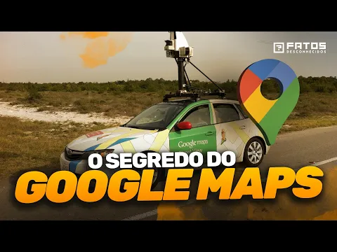
Google Cars, Cameras, And Street Mapping
The development of Google Street View marked a new chapter in the platform’s history.
As mentioned in the video from the channel, the first vehicles used by Google carried a camera weighing an impressive 227 kg, mounted on a van.
These setups were responsible for initiating the systematic capture of images of streets around the world.
Today, the reality is quite different.
The video also shows that technology has evolved to portable equipment weighing only 7 kg, even carried in backpacks.
Mobility has become crucial to reach hard-to-access areas.
In these locations, Google resorts to creative solutions: bicycles, motorcycles, camels, and even astronauts have contributed images to the company’s database.
Artificial Intelligence In Google Maps
With the data collected in the field, the next step depends on artificial intelligence.
The content published on the channel Unknown Facts highlights that Google’s AI recognizes traffic signs, changes in constructions, and even newly opened businesses.
All of this is processed to ensure that Google Maps remains updated and reliable.
This constant updating also depends on the users themselves.
The technique known as crowdsourcing allows people to communicate changes, review establishments, and correct information.
This spontaneous collaboration ensures that even areas with little presence of digital infrastructure receive accurate coverage.
The Contribution Of Users And Real-Time Data
If you have ever received a notification asking you to rate a place after visiting it, know that you are participating, even if indirectly, in the maintenance of the system.
As explained in the video from the channel Unknown Facts, Google uses data collected from smartphones to monitor movement in real-time.
This includes everything from peak times at restaurants to traffic flow on highways.
Although this data is anonymized through a technique called “differential privacy,” which prevents users’ personal identification, the massive data collection has always generated discussions about privacy.
Germany, for example, imposed strict restrictions on Street View, requiring Google to obtain explicit consent from residents and allowing them to opt-out of showing their homes.
Only in 2023 was the country actually added to the system.
Locations That Google Maps Could Not Map
Despite its global reach, Google Maps cannot access certain territories.
The video reports that countries like North Korea remain outside the platform’s reach due to political issues.
Additionally, islands like Moruroa, where France conducted nuclear tests, and the Riva Larg facility, specialized in nuclear fuel reprocessing, are purposely blurred.
Even military bases, such as the one in Anagri, Greece, remain partially concealed for national security reasons.
Monetization Of Google Maps And Local Businesses
A common question is how Google profits from a free service for users.
As highlighted in the video from the channel Unknown Facts, Google Maps’ profitability mainly comes from companies that pay to be featured prominently in search results.
Restaurants, hotels, and stores pay for advertising on the map, promoting their brand in a targeted way.
The platform is estimated to generate over 3.5 billion dollars a year.
Besides advertising, logistics companies hire exclusive Maps services to track fleets in real-time, optimizing routes and reducing operational costs.
Immersion And The Future Of Google Maps
The next frontier for Google Maps, according to Google itself, is immersion.
The goal is to combine satellite images, drone footage, and Street View photos to create three-dimensional experiences that simulate real visits.
The target?
To allow anyone to explore the world from home — all with visual and contextual accuracy never seen before.
The video from the channel Unknown Facts concludes that this ambitious vision still depends on a considerable amount of data and ongoing user engagement, making the role of each individual essential for the maintenance and expansion of the platform.
And you, have you ever imagined how much information Google collects from your smartphone without you realizing it?