Portuguese
  Spanish
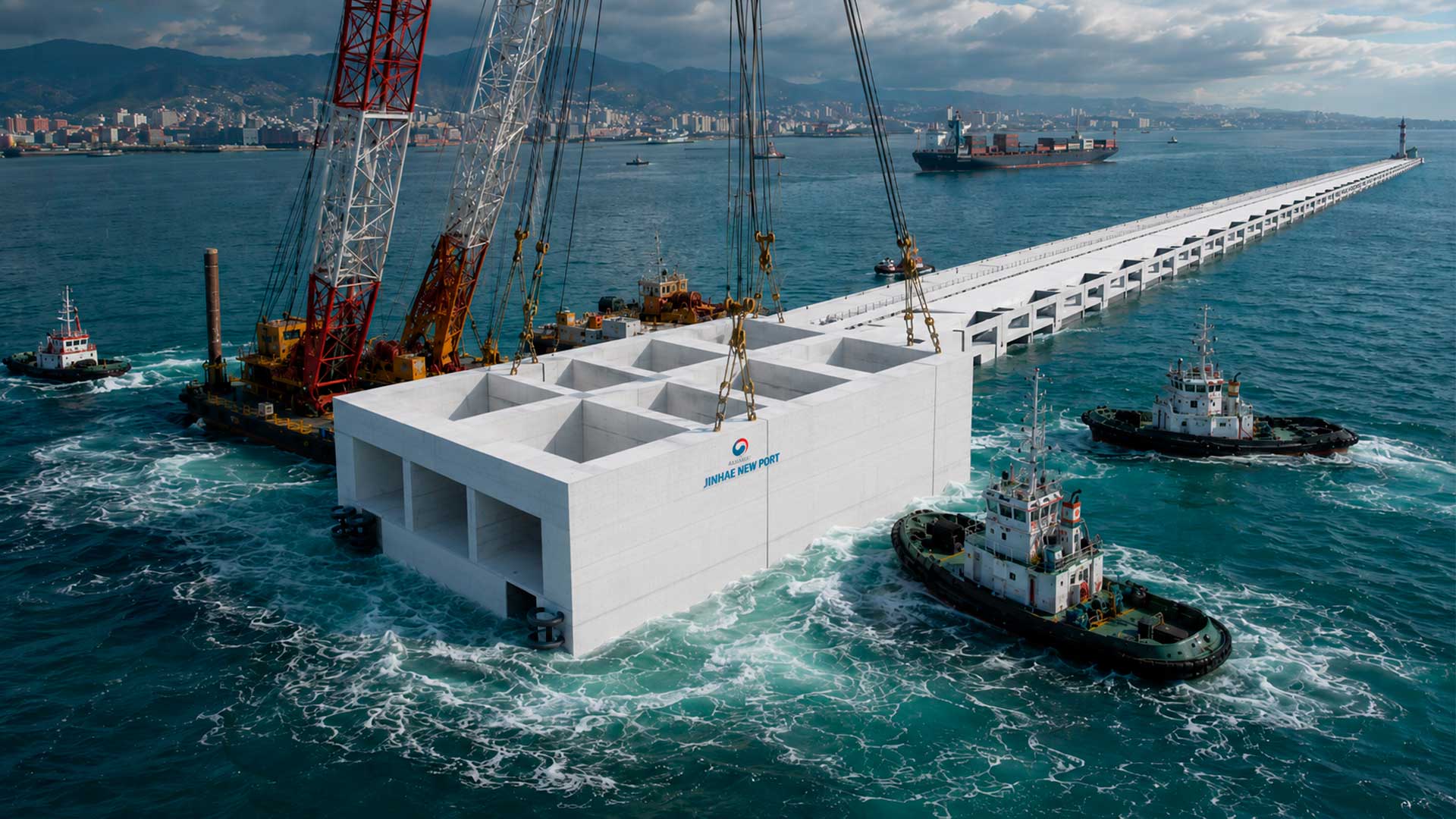
 Em seguida, a infraestrutura começou a ser erguida. Estruturas de concreto, pistas de pouso, portos e hangares foram construídos, transformando os recifes em bases operacionais.
O resultado foi a criação de ilhas artificiais que não apenas mudaram a geografia local, mas também a dinâmica estratégica da região.
Impacto na região
A construção dessas ilhas artificiais gerou tensões com países vizinhos que também reivindicam partes do Mar do Sul da China, como Filipinas, Vietnã, Malásia e Brunei.
-
Brazil to Phase Out Gasoline Subsidy, Fuel Prices Set to Rise Amid National Debate

-
Brazil Aims to Boost Critical Mineral Production to 12.2% of Global Output, Targeting Battery and Tech Industries
-
Brazil’s New National Mining Plan Aims to Transform Fertilizer Market and Reduce Foreign Dependency from 87.3% to 34.9%, Boosting Agriculture and Food Production
-
Brazilian Government Plans to Auction Over 500 Road Bridges on São Paulo Stock Exchange in 2026, Promising New Wave of Concessions


Além disso, a presença militar ampliada da China na região é vista com preocupação por outras potências, como os Estados Unidos, que defendem a liberdade de navegação em águas internacionais.
As ilhas artificiais servem como postos avançados, permitindo à China projetar poder e realizar operações de vigilância em uma das rotas comerciais mais movimentadas do mundo.
Essa transformação do Mar do Sul da China em um ponto estratégico de controle e vigilância é um dos desenvolvimentos geopolíticos mais significativos dos últimos anos.
With the base formed, engineers installed foundations, piles, piers, buildings, internal roads, radars, helipads, and runways. The result was the conversion of maritime formations into fortified outposts.
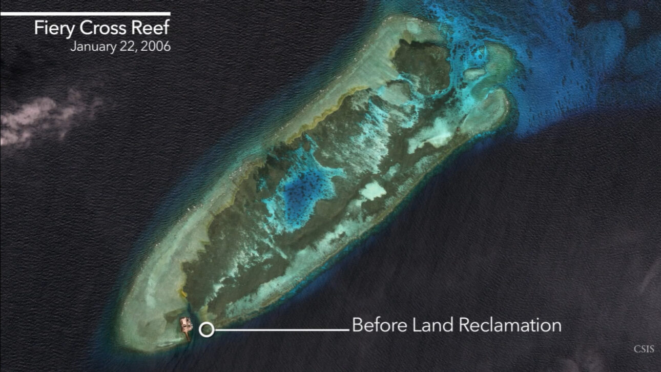
One of the most cited examples is the Fiery Cross Reef, known in China as Yongshu and in Vietnam as Đá Chữ Thập. Previously, the formation appeared as a narrow strip of reef.
Starting in 2014, dredgers began to suck sand from the seabed and deposit it on the coral. In a few years, the site became home to an artificial island of about 270 hectares.
The structure received a runway of approximately 3,000 meters, reinforced shelters, a deep-water port, fuel tanks, and radar towers.
Runways, ports, and radars expanded the Chinese presence
The model applied at Fiery Cross also appeared in other Spratly formations, such as Subi, Mischief, Gaven, Johnson South, and Hughes.
Previously restricted to nautical charts and diplomatic disputes, these names began to appear in defense reports and strategic analyses.
The artificial islands expanded China’s ability to operate further from the mainland. As a result, China reduced its dependence on bases in Hainan or other coastal areas.
The runways at Fiery Cross, Subi, and Mischief form a kind of operational triangle in the Spratly. This infrastructure extends the reach of aircraft, drones, and patrols in the region.
The deep-water ports allow Chinese coast guard and navy vessels to remain longer in the area, with support and refueling possibilities.
The radars and communication structures enhance the monitoring of ships, planes, and commercial routes.
In practice, the artificial islands have come to serve as surveillance points in an area of intense maritime and air traffic.

Legal dispute gained a new physical reality
The transformation also created a legal challenge. Under the UN Convention on the Law of the Sea, formations submerged at high tide do not generate territorial sea or Exclusive Economic Zone.
Lands naturally above water can project maritime rights. By transforming reefs and sandbanks into permanent artificial islands, China altered the physical reality of the region, although this does not automatically mean recognized legal change.
In practice, the presence of concrete, runways, ports, and radars makes the dispute more difficult to reverse. What was once a fight over reefs has come to involve fixed, occupied, and operational structures.
For neighboring countries like the Philippines and Vietnam, this presence has changed the routine at sea. Fishermen and captains have started to report increased contact with Chinese ships in areas traditionally used for fishing.
Foreign pilots have also started to hear radio warnings when approaching areas claimed by Beijing.
Why the dispute goes beyond the reefs
The South China Sea is one of the most important maritime routes on the planet. About one-third of global maritime transport passes through these waters, including oil tankers, cargo ships, and container ships.
Therefore, the dispute does not involve just isolated formations. Practical control over these areas can influence trade routes, transportation costs, energy security, and freedom of navigation.
The presence of navies from countries like the United States, United Kingdom, France, Japan, and Australia is linked to this point.
Whoever monitors the traffic and imposes presence over strategic routes gains influence beyond the maps.
In about 12 years, China has not only built artificial islands. It has changed the visible geography of part of the South China Sea and transformed disputed reefs into structures capable of altering the regional balance.
This article was prepared based on the base material provided in the prompt, with data, numbers, and statements preserved as per the consulted content.