






 Portuguese
  Spanish


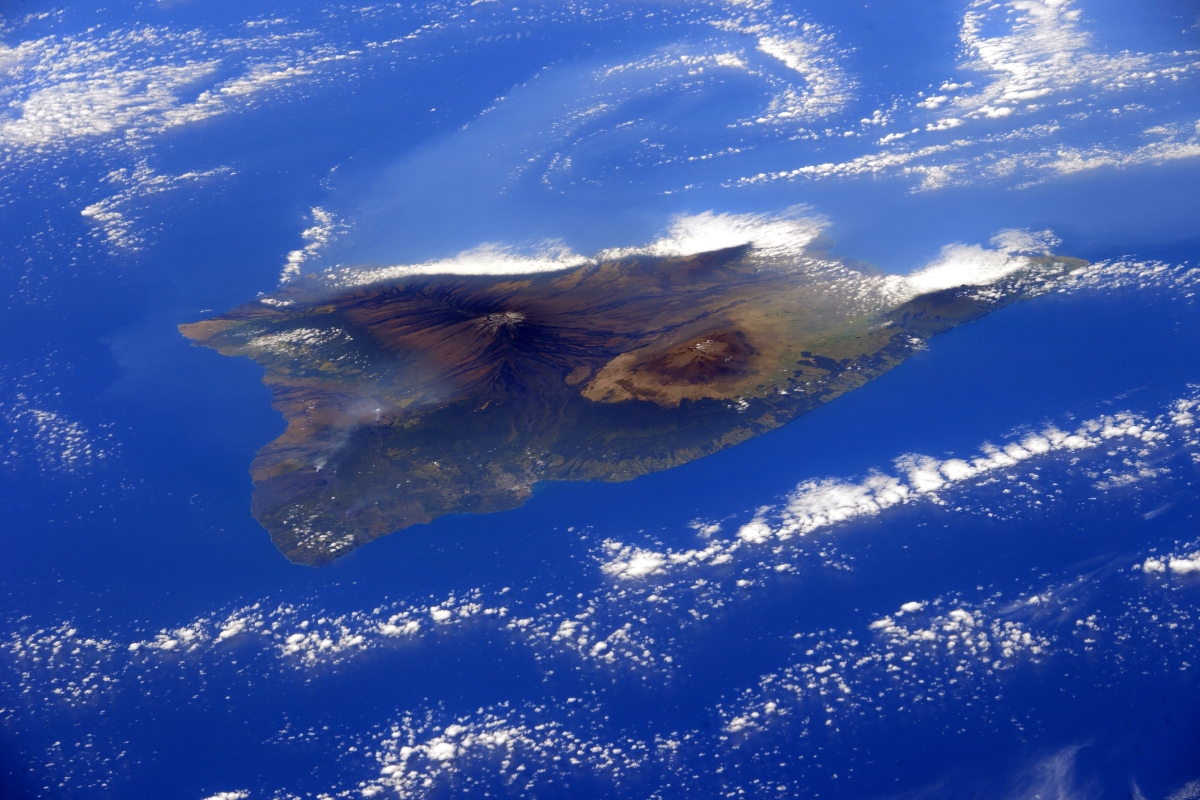


A Team of Seismologists Detailed the Structure Beneath Hawaii at 2900 Kilometers Depth and Indicated a Core of Iron and Solid Rock That May Stabilize the Hotspot and Influence the Pacific Board
Below Hawaii, a colossal mass hidden near the boundary between the mantle and core has gained clearer contours. The main signal is straightforward: the material appears solid and rich in iron, not a mushy and partially melted region.
This detail changes the interpretation of what keeps the Hawaiian hotspot active for such a long time. In a scenario of disputes and presence in the Pacific, any factor that sustains a stable geological mechanism helps explain why the archipelago remains a fixed reference on the map.
The Spot Is Near the Core at 2900 Kilometers and Changes the Path of Seismic Waves
The structure is at the bottom of the mantle, resting on the boundary with the core, about 2900 kilometers from the surface. At this depth, seismic waves slow down intensely, creating a rare and valuable signature.
-
Scientists Develop Needle-Free Insulin That Penetrates Skin, Reduces Glucose in Animals Within an Hour, Paving the Way for Diabetes Patches and Creams for Humans

-
After 40 Years of Research, Powdered Coconut Water to Be Produced in Brazilian Biorefinery, Aiming to Revolutionize Health for Children, Elderly, and Hospital Patients
-
Queen Guitarist Brian May Collaborates with ESA Scientists to Study Asteroids Bennu and Ryugu Using 3D Simulations
-
Largest Known Single-Piece Meteorite, Weighing 60 Tons, Puzzles Scientists with Its Intact Fall and Lack of Visible Crater


These regions are known to concentrate large anomalies from within the Earth. They frequently appear near persistent volcanic areas, like those associated with Hawaii.

High Iron Suggests a Rigid Piece That Helps to Keep the Hotspot in Place
The presence of iron indicates a material more conductive of electricity and heat. In practice, this favors thermal conduction and helps to keep the column of hot material more concentrated and enduring.
As a result, the hotspot tends to become more anchored, rather than spreading or losing strength easily. The effect is stabilization, something that continues to fuel the engine that drives the formation of the islands.
Method Combines P and S Waves and Improves the Vision of What Exists in the Depths
The mapping relies on signals from earthquakes that travel across the planet. Previously, readings depended more on compressional waves, which limited the level of detail.
The approach used also incorporates shear waves, which add information about how the material reacts to different movements. This combination has allowed for a more accurate portrayal of what causes the waves to slow down in that zone.
The Hypothesis of Melted Material Loses Strength with the New Reading
The result points to solid rock instead of an area with a high proportion of melting. This weakens the idea that the spot would function as a kind of sticky and partially liquid reservoir.
By swapping the image of melted material for a rigid structure rich in iron, the interpretation starts to favor stability and persistence, two factors that change the strategic reading of the Pacific.
According to Live Science, Science and Technology News Site, the Structure May Be an Ancient Vestige and Helps to Explain the Persistence of Hawaii
The possible origin includes remnants from very ancient phases of the planet, such as the crystallization of a magma ocean at the base of the mantle or melted material that recrystallized after melting episodes in the past.
There is also a chance of variations among these large spots around the world. Some may be linked to the sinking of oceanic crust rich in water into the depths, while others may involve the influence of material from the core itself.
Not All Deep Spots Are Alike and This Changes the Map of Geological Influence in the Pacific
The difference between spots may define how each hotspot behaves and how long it remains active. Where the engine is more stable, volcanism tends to maintain a long signature in the territory.
In the Pacific, this means that certain areas continue to operate as fixed references, while others may change in intensity over time, repositioning the reading of presence and influence on the board.
The central idea is simple and heavy: a deep, solid and rich in iron piece can help keep the Hawaiian hotspot alive for longer. This sustains a volcanic chain that continues to outline the archipelago on the map.
When the base is rigid and efficient in conducting heat, the system becomes more localized and persistent. This type of detail affects the Pacific and changes the strategic reading.







2900km… tem certeza disso? Eu tenho dúvidas. Qual a maior profundidade dos oceanos?
Impossível!!! A terra tem 12740km de diâmetro. Com certeza são 2900m!!!
Vdd hj em dia todo mundo q ser cientista ele e petrologo?