Portuguese
  Spanish
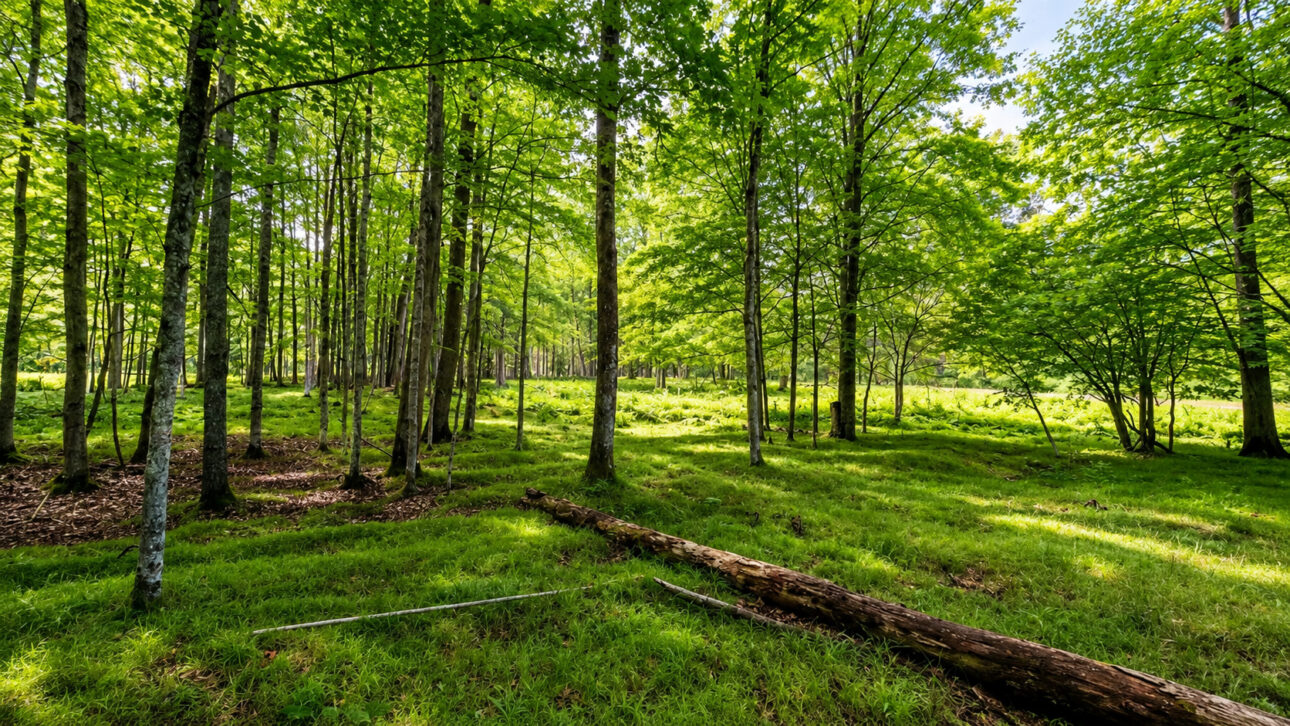
Indigenous agriculture in Michigan reveals raised beds, enriched soil, and planting signs preserved for centuries under a forest on the banks of the Menominee River
Under a forest in the northern United States, researchers found raised indigenous fields and their agriculture that were redone for 600 years and occupied an area 10 times larger than previously thought. The marks were at the Sixty Islands archaeological site in Michigan’s Upper Peninsula.
The information was published by Dartmouth College, a research university in the United States, on June 5, 2025. The study showed that ancestral Menominee communities modified the soil to grow food in a cold region, with dense forest and little time available for planting.
The discovery changes the image that the forest always occupied that space without major human interventions. The terrain preserved signs of a planned indigenous agriculture, done with land preparation, raised beds, and constant soil renewal.
-
Designer Transforms Discarded Eggshells into Shape-Shifting Modular Lamp

-
Lucy, the 3.2-million-year-old fossil that reshaped our understanding of human origins, makes a rare journey from Ethiopia to Abu Dhabi.

-
Plow Uncovers 50 kg Iron Meteorite in Wisconsin Farm, First of Its Kind in Dane County After 15 Years Hidden
-
Starlink’s Direct-to-Cell Internet Takes Major Step Forward in Brazil with Regulatory Approval, Partnership with Carriers Needed for Antenna-Free Service


Fields that turned into forest held an organized agricultural area
The Sixty Islands site is located on the banks of the Menominee River in Michigan. The area is part of a historical landscape linked to the ancestors of the Menominee people, who used the site for cultivation and other community activities.
The forest grew over the fields and made part of these marks almost impossible to see from the ground. Even so, the land continued to hold lines, curves, and elevations that reveal where the ancient beds were constructed.
The fields were not small isolated gardens. They formed a wide production area, set up in groups of raised earth strips. This design shows collective work repeated over many generations.
Technology revealed the terrain that the trees hid
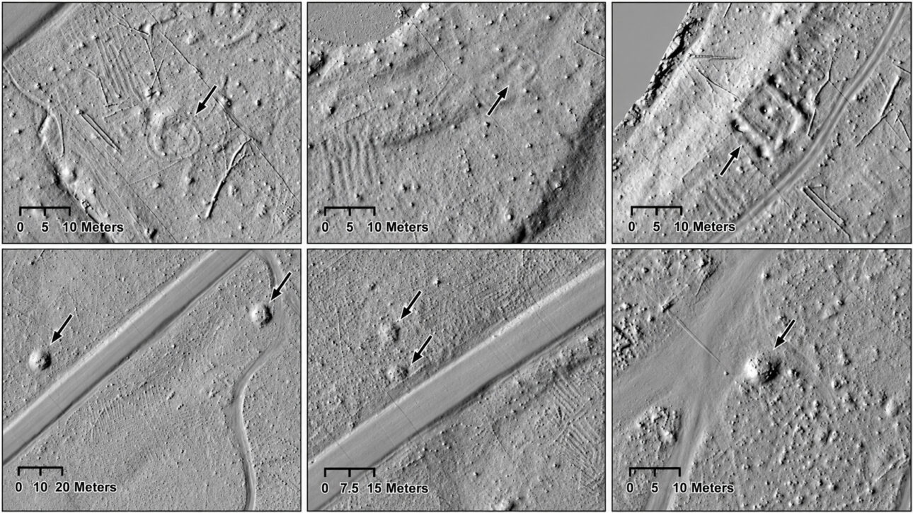
In May 2023, the team used drones with lidar technology to analyze about 330 acres of the land. The equipment uses light pulses to record the shape of the soil and allows seeing details hidden under trees and vegetation.
Dartmouth College, a research university in the United States, reported that the survey covered approximately 40% of the site. The identified agricultural area proved to be 10 times larger than previous estimates.
The images revealed parallel strips on the ground, resembling repeated patterns over the landscape. These strips were the raised fields used to organize the planting and keep the land prepared for new crops.
Soil rebuilt over centuries shows care for fertility
In August 2023, researchers excavated three raised beds at different points of the site. The analysis of charcoal found in the soil showed that these areas were rebuilt over 600 years, starting around the year 1000.
The finding reveals that cultivation did not rely on a single occupation. The fields underwent changes over time, with new soil, adjustments in shape, and renewal of the areas used for planting.
The excavations also found charcoal, pottery fragments, and other objects. These materials indicate the use of fire remains and domestic waste in field preparation, while soils from wet areas helped enrich the land.
Raised beds supported corn, beans, and squash
The indigenous raised fields were between 4 and 12 inches high. They were formed by grouped strips of soil, used to cultivate corn, beans, squash, and other plants.
Food production in a cold climate region required observation of the terrain, selection of the most suitable areas, and soil maintenance. Indigenous agriculture in Sixty Islands shows that knowledge of the landscape was part of the survival and organization of communities.
The size of the area found also indicates that fieldwork required many people and planning. Planting, recovering the soil, and expanding the beds were tasks that needed to be repeated over many years.
Indigenous agriculture changes the way we look at ancient forests
A large part of the former agricultural fields of North America disappeared with the intense use of the land, opening of pastures, tree cutting, and urban expansion. Sixty Islands remained preserved because the forest covered part of the marks left on the ground.
The study shows that landscapes seen as natural can hold signs of ancient human work. The forest did not completely erase the beds, it only hid an agricultural area built before the arrival of European colonizers.
The discovery also reinforces that ancestral indigenous peoples used their own techniques to increase food production. Soil preparation, the use of organic matter, and the reconstruction of fields show a deep relationship between cultivation, territory, and accumulated knowledge.
Sixty Islands preserves an important part of the agricultural history of indigenous peoples in the northern United States. The elevated fields reveal that the current forest grew over a landscape transformed by work, care, and planning over centuries.
More than marks on the terrain, the beds show a way of producing food adapted to the climate, soil, and local conditions. The discovery helps to understand that indigenous agriculture left complex works even without buildings, roads, or stone walls.
Do you think areas hidden under forests should be investigated before construction, roads, or soil exploration? Leave your opinion in the comments and share this discovery.