
 Portuguese
  Spanish
Six formations in Ceará will be recognized as mountains by the IBGE based on new technical criteria that update the classification of Brazilian relief, increase the state’s weight on the national geodiversity map, and are expected to influence educational materials, academic research, and debates on environmental conservation.
Starting from the second half of this year, six natural formations in Ceará will be officially recognized as mountains by the IBGE, in a change linked to the Brazilian Relief Classification System, created to update since 2019 the criteria used in defining current Brazilian landscapes.
Reclassification changes Ceará’s relief
The areas are the Meruoca, Uruburetama, and Serra das Matas ranges, in addition to the massifs of Baturité, Pereiro, and Central. Ceará will gain national prominence in the reading of the relief.
The update considers technical criteria defined by researchers from the IBGE, the Geological Service of Brazil, and federal universities. The study evaluates the difference in altitude between base and peak and characteristics.
-
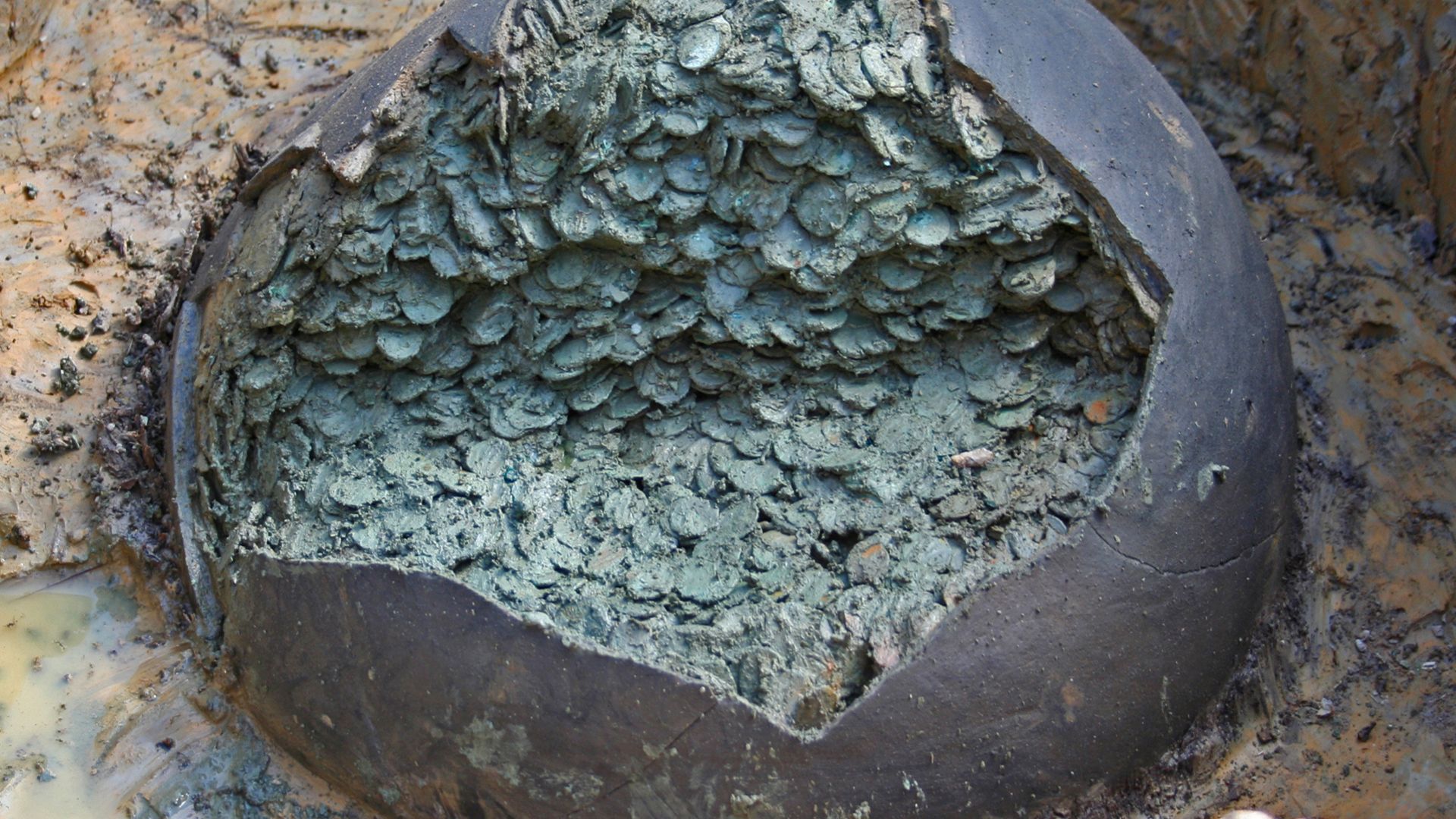
Hospital Cook Discovers 1,700-Year-Old Pot of 52,503 Roman Coins Using Metal Detector in Field

-
Salvador’s Acarajé Vendors Turn Used Frying Oil into Income by Selling it for Biodiesel Production
-
Volunteer Revives Dead Lake in Bengaluru Overnight, Doubling Water Capacity and Attracting Kingfishers and Herons
-
1909 Train Car Once Destined for Abandonment Transformed into Luxury Accommodation in the U.S. After $3,000 Restoration


To receive mountain status, the formations must present at least 300 meters of altimetric amplitude. They must also have peaks, steep slopes, and spatial relevance.
Mountains will be included in educational materials
The change will have a direct impact on education. With the official publication of the Brazilian geodiversity map, scheduled for this year, the concept of mountains will start to appear in educational materials and geography studies.
The new framework is also expected to stimulate research on climate, biodiversity, human occupation, and environmental characteristics of these regions. The classification expands the technical base to understand areas with regional importance, but not officially treated as mountainous.
Recognition may guide environmental debates
The new classification does not automatically create protection for these areas. Even so, it can serve as a reference for future legislation aimed at the conservation of mountainous environments.
With six formations recognized, Ceará will be pointed out as the most mountainous state in the Northeast by the IBGE. What do you think of this recognition of Ceará’s mountains and the possible impacts on education, research, environmental preservation, and the appreciation of the state’s natural landscapes? Share your opinion in the comments.
Source: gazetahora1


